York's Local List
You can read the current provisional York Local List below, or view parts of the list by selecting a Council ward or using the location search below:ACOMB
| Site | Address | Date | Description |
| Coach House | Millgates View on map |
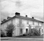
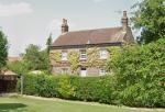
1849 | Constructed as a gentleman’s residence originally called Acomb Park House, it comprised two floors with five bay windows. At one time it was the BIG house in Acomb, and believed to have been owned by Victorian tycoon Montague Burton, who founded the Burton clothes retail empire. Its grounds stretching down to the river. Subsequently used as a nursing home. The main house was demolished in c.2008 by York Housing Association to provide affordable housing. The coach house remains, although converted as housing, and is in its original form. |
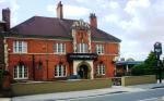
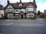
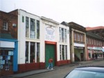
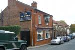
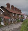
| The Marcia Grey Public House | Front Street View on map |
c.1900 | A purpose-built public house replacing an earlier pub on the same site known as The Square and Compasses. By 1817 its name had been changed to The Marcia after a favourite York racehorse. Due to the colour of the racehorse, between 1823 and 1838 it was named The Grey Mare. By 1843 the name had been changed back to The Marcia, sometimes referred to as The Grey Marcia. In the early twentieth century, it was rebuilt on a larger scale and for a short while it was known as The Poacher. For decades it provided the base for a range of sporting clubs and teams in Acomb and thus has a strong link with the social history of the village. It is also aesthetically significant as it provides a notable architectural feature on Front Street. (HER no. MYO4019) |
BISHOPTHORPE
| Site | Address | Date | Description |
| 31-35 Main Street | Bishopthorpe View on map |
18/19th century | The village butcher's shop including the slaughterhouse and living quarters known as the Walnut House on Main Street is a familiar landmark in Bishopthorpe. The business was started by George Scholey upon his arrival in 1869 and passed down through generations. The butcher shop is a valued local amenity which gives character to the conservation area thanks to its pleasant blue and white painted frontage. It is also of interest as a rare survival of a long-established butcher's business in the village. (HER no. MYO4020) |
| No 8, 10, 12, First School House | School Lane, Bishopthorpe View on map |
1763 | The first schoolhouse in Bishopthorpe was built in 1763, designed by John Crosby for Archbishop Drummond, on a site known as Lord’s Waste. This was replaced with a brick-and-slate school building in 1815. Archbishop Harcourt commissioned the school to be rebuilt in 1846 to provide a girls’ school and residence for a schoolmaster and mistress. As the population grew, a fourth classroom was added around forty years later. It has since been converted into three residential units. It holds high historic and communal value and demonstrates the improvement of education in the area. (HER no. MYO4021) |
| The Archbishop of York School | School Lane & Main Street, Bishopthorpe View on map |
1846 | The school was built by Archbishop Harcourt on manorial land in 1846, close to the original school house which he repurposed for a girls’ school the same year. It was used as a schoolhouse until 1967 when the York’s CE Junior School was built. It still has considerable community use for playgroups, various school clubs and scouts. It is of historic importance, standing at a significant position on the main approach to Bishopthorpe from the A64. (HER no. MYO4022) |
CLIFTON
| Site | Address | Date | Description |
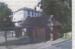
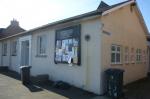
| Electrobus station | Clifton Green View on map |
Standing in front of Clifton Green, the Electrobus Station is a small building used for charging battery-powered buses which operated between Clifton and Stockton Lane from 1915 to 1923. It was later used as a police box, a bus shelter as well as a public toilet. Due to vandalism, it was put on the market and in 2011 it opened as a barber’s shop named The Gents. It is an important reminder of York’s historic transport system and a valued local amenity. (HER no. MYO4011) | |
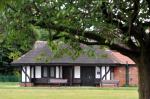
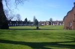
| Bowls Pavilion | Clarence Gardens View on map |
1913 | Probably designed by the City Engineer. Included in the list because it has been a valued and useful amenity in Clarence Gardens for many years; and because it forms an attractive and appropriate focal point characteristic of its time. (HER no. MYO4012) |
HEWORTH
| Site | Address | Date | Description |
| Bowls Pavilion | Glen Gardens View on map |
c1913 | Pre 1st World War, probably designed by the City Engineer. A valued and useful amenity in the Gardens for many years. It forms an attractive and appropriate focal point characteristic of its time. (HER no. MYO4013) |
CLIFTON
| Site | Address | Date | Description |
| The Garth, St. Olaves Road | Bootham View on map |
1886 | The Garth is a private residence, originally known as Low Royd. It was built for Mr. H. M. Platnauer, Keeper of the Yorkshire Museum and one of the original founders of the Museums Association. It was likely designed by James Demaine, an older partner in the architectural firm Demaine and Brierley. In 1905 a new wing designed by Walter Brierley was added to the original house. The wing retains exceptionally fine fixtures and fittings designed by Brierley. The building has high historical and evidential value due to its association with two highly regarded York architects and for its connection with a local personality prominent in the late Victorian cultural life of the City. (HER no. MYO4010) |
HEWORTH
| Site | Address | Date | Description |
| Yearsley Pool | Haley’s Terrace View on map |
1908 | The ‘New Yearsley Baths’ replaced an old bath in the River Foss downstream of Yearsley Bridge. It was built by Rowntree & Co. and designed by Fred Rowntree in 1908. Originally it would have cost around £3,000 and it was gifted by deed to the citizens of York on 4th May 1909. The original design held 226,890 gallons of water, measured 144 feet long by 51 feet wide, and was open-air. The facility was roofed over in 1964/5 and further modernised in 2007. The pool tank is relatively unaltered and the poolside cubicles retain many original features. The site has high communal value, providing a popular sports and leisure centre in the area. (HER no. MYO4023) |
OSBALDWICK AND DERWENT
| Site | Address | Date | Description |
| Telephone Kiosks, Dunnington | York Street, Common Road View on map |
1935 | The red kiosks fit well with their surroundings and are examples of Sir Giles Gilbert Scott's K6 design that is becoming increasingly rare. (HER no. MYO4103) |
| Mounting Block, Dunnington | No 13 Kiln Cottage View on map |
Located at the junction between Common Road and Water Lane, the mounting block is an object unique to the village and holds both local and historical importance. Mounting blocks were once used to mount and dismount from horses until the late 18th century. With the location of the mounting block being near the Village Cross, it could suggest this area of the village marked the entrance/exit to the centre of the village. The mounting block is also situated within Dunnington conservation area. (HER no. MYO4094) | |
| The Greyhound Pub, Dunnington | York Street View on map |
19c | The pharmacy in Dunnington was once known as The Greyhound pub and is located within the Dunnington Conservation Area. This 19th century building has a gated carriage entrance to the left of the property and is rendered. There are four Georgian-styled 16 pane sash windows along the upper floor of the property and two modern bay windows have been added to the ground floor either side of the entrance. The fanlight above the doorway has a simple design which complements the sash windows. With the pub closing down in 2014, the village lost a social asset, however, the pharmacy use perpetuates the building's communal value. The first floor of the building has been converted into flats. (HER no. MYO4095) |
| Road Bridge, Dunnington | York Street View on map |
1910/13 | Brick, built over old rail track bed. Adds interest and character to access into village. Only remaining structure of the village’s association with the Derwent Valley Light Railway. (HER no. MYO4096) |
| Scout and Guide Building, Dunnington | Garden Flats Lane, Dunnington View on map |
Early 20c | Former telephone exchange in arts & crafts style, visually attractive. An important community facility. (HER no. MYO4097) |
| Cross Keys Pub, Dunnington | Common Road View on map |
19c | The Cross Keys pub is a 19th century public house located within the Dunnington conservation area. Existing alongside The Greyhound circa 1823, the Cross Keys is a historically important building within the historic core of the village and is located near the Village Cross, which is where the village streets meet. The pub has a mix of single pane sash and 4 pane sash windows and the front elevation is rendered. The pub continues to be a social and communal asset to the village. (HER no. MYO4098) |
| Metal Seat, Dunnington | Common Road View on map |
Circular metal seat surrounding beech tree planted in 1935 to commemorate the Silver Jubilee of George V. Adds character and interest to the village. (HER no. MYO4099) | |
| Methodist Church, Dunnington | Common Road View on map |
1868 | Located on Common Road, the Methodist Church was built in 1868 to replace an older Wesleyan Methodist church on York Street. The church represents an increase in Quaker followers during the late 19th and early 20th century within the village. An interesting and visually attractive building, the church has twelve Gothic-styled sash windows, six on either side of the front elevation. The church still serves the village today with regular services and events and is within the village conservation area. (HER no. MYO4100) |
| Large Barn, Dunnington | Eastfield Lane View on map |
Early 19c | This agricultural building sets an historic tone to the entry to the village from Church Balk. Of English garden wall brickwork it is a visible reminder of Dunnington’s farming past. (HER no. MYO4101) |
| School Bell, Dunnington | Petercroft Lane View on map |
?1836 | Mounted on a wall near the roof of the new Doctor’s Surgery. An interesting piece of village history which adds character to the village setting. (HER no. MYO4102) |
| Dunlea & Virginia Cottages | Main Street East, Holtby View on map |
19c | Vernacular two storey detached cottages believed to have originally accommodated the gardener & groom at The Old Rectory. Local clamp brick walls with ‘tumbled gabling’. End and ridge clamp brick dentilled chimney stacks with tall plain fireclay pots. String course at first floor level raised brick verge at one gable. Brick-on-end lintels over openings. Exposed stone boulder foundations. Clay pantile roof. Wood casement windows (Dunlea) wood simulated vertical hung sash type windows (Virginia). (HER no. MYO4107) |
| Laurel Cottage, Holtby | Main Street East, Holtby View on map |
Laurel Cottage is a two-storey detached house located on Holtby Lane, Holtby. The architectural type of the cottage is Vernacular, which is one of two architectural styles within the village and is typical of older (circa 18th century) and small to medium houses and cottages in the area, suggesting the cottage is older. The cottage was built with local clamp brick and the chimney stacks are dentilled. The dormer windows are set half into the roof space of the cottage, which makes this is a stand out feature as no other cottage has this particular feature. The roof is Welsh Dark slate, which became popular in the 19th century when transport became more accessible and is typically used on newer buildings at the time. This suggests that either the cottage was built during the 19th century or the owners at the time were able to afford new slate roofing. The cottage is located within the village's conservation area and adds to the village street view. (HER no. MYO4108) | |
| Holtby House | Main Street East, Holtby View on map |
1840/60 | Large Polite two storey detached house in commanding position overlooking Main Street. Clamp brick walls with dressed stone sills and lintels. End and ridge dentilled brick chimney stacks with tall fireclay pots. Westmoreland slate roof. Cast iron gutters and rainwater pipes. Wood vertical hung sash windows for up to 12 small panes. Extensive range of original outbuildings including conservatory, two storey 18th C cottage, range of loose boxes with adjoining tack room, hay loft and coach house with many original fixtures and fittings. The courtyard, partly paved with York flagstones, has a mounting block of local clamp brick with flagstone steps, a large wall hung bell, street lamp and double entrance gates. |
| Poverty Farm, Holtby | Main Street East, Holtby View on map |
Vernacular two storey detached farmhouse in a prominent position overlooking Main Street. Local clamp brick with ‘tumbled gabling’, end dentilled brick chimney stacks with plain fireclay pots. Dentil course at eaves, rubbed brick-on-end lintels over openings. Raised brick verges with brick kneelers at eaves. Clay pantile roof. Wood vertical hung sash windows for 4 panes. Examples of original Yorkshire horizontal sliding sash windows in evidence. Farm buildings complex and extensive garden grounds to rear. (HER no. MYO4109) | |
| The Cottage, Holtby | Main Street East, Holtby View on map |
Vernacular two storey house occupied until 1866 by the victualler of the Duke of Wellington Pub. Local clamp brick with ‘tumbled gabling’ End and ridge dentilled brick chimney stacks with tall ornamental fireclay pots. Rubbed brick-on-end lintels. Roof dark grey Welsh slates. Wood vertical hung sash windows for 4 panes of glass. Rear outbuildings include a two storey cottage. Extensive grounds including Public Path. (HER no. MYO4111) | |
| The Old Rectory | Main Street East, Holtby View on map |
c1846 | Polite two storey detached house designed by York architect G Townsend Andrews for the Rev T C Price. Clamp brick walls with end and ridge dentilled brick chimney stacks with tall plain fireclay pots. Brick-on-end lintels, projecting base course of brick, first floor string course and sandstone sills. Wood vertical hung sash windows for up to 12 panes of glass. Dark grey Welsh slate roof, cast iron gutters and fall pipes. Entrance porch with key stone, cope and parapet of dressed sandstone, enclosing wood painted door with12 small panes of glass and a fanlight with 4 panes. Extensive grounds including pond, paddocks and woodland beyond ‘ha-ha’ formed with clamp brick retaining wall. (HER no. MYO4110) |
| Sycamore Cottage | Main Street West, Holtby View on map |
Situated west of Holtby Lane, Sycamore Cottage is a Vernacular two-storey detached cottage made of local clamp brick. The roof is made of reddish clay pantiles and the chimney stack is dentilled. The cottage has vertical hung sash windows. Adds to the village streetscape and within the village conservation area. (HER no. MYO4112) | |
| Rose Cottage, Holtby | Main Street West View on map |
Rose Cottage is a Vernacular two-storey detached house made of local clamp brick with one dentilled chimney stack. Some sections of the brickwork appears to be newer compared to other sections, suggesting repairs. The cottage appears that have retained its original clay pantiles which was typical of older cottages within the village. Adds to the village streetscape and is within the village conservation area. (HER no. MYO4113) | |
| Weir House, Holtby | Holtby Lane View on map |
Vernacular ‘double pile’ two storey detached house with rear wing. Clamp brick walls, end dentilled chimney stacks. Brick-on-end lintels over openings. Casement windows with up to 6 small glass panes, including random examples of bottle glass in each. Extensive garden grounds and paddock area to rear. (HER no. MYO4114) | |
| Village Pumps, Holtby | Main Street, Holtby View on map |
Two boxed pumps are preserved in Main Street as a reminder that this was a means of providing a safe and reliable water supply to the village prior to piped supplies in the 1950’s. (HER no. MYO4115) | |
| Village Pump | Holtby Manor |
1837 | A country pump which supplied both the house and a large cattle trough until the 1960’s. It is embossed ‘1837-BA Esq’ the landowner being Benjamin Agar. (HER no. MYO4115) |
| Post Box, Holtby | Main Street View on map |
Victorian | Set in clamp brick boundary wall of Holy Trinity Church, embossed Crown and ‘VR’. (HER no. MYO4117) |
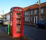
| Phone Box, Holtby | Main Street View on map |
Early example of red GPO telephone box embossed Crown on each face, still in use. (HER no. MYO4118) | |
| Signposts, Holtby | Main Street View on map |
Pre war | Cast iron, black and white, round plate on top embossed ‘Yorks North Riding C C’ each showing direction and distance to next villages and to York. (HER no. MYO4119) |


DRINGHOUSES AND WOODTHORPE
| Site | Address | Date | Description |
| Ashfield House | York Technical College View on map |
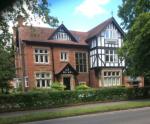
c1850 | Originally named the Ash Tree Farm, the large house and extensive gardens were built for George Swann, a banker in a much respected York firm in 1842. The name was changed to Ashfield House when it was sold on auction in 1873. The auction brochure describes the house as very attractive and valuable, with 4 reception rooms and 13 bedrooms. In the 20th century, it was the home of the Lycett Greens. The whole estate became the property of York Corporation in 1943 and served as billeting quarters for the RAF. Most recently it was the property of York College who greatly altered the interior of the house. It is one of two remaining large Victorian properties in Dringhouses (there were originally four). It has high aesthetic value due to its significant style including the Fox weather vane and historic value due to its association with prominent York families. (HER no. MYO4026) |
| Aldersyde Cottage & Stable Cottage | Ancillary cottages to Aldersyde House View on map |
1895 | Aldersyde House is an English Heritage-listed grand house designed by W.G Penty’s son Arthur and considered his first important work. The two cottages down Old Moor Lane have the same architectural features, weather vane, windows, chimneys etc. and are probably by the same architects, Penty & Penty. The old fernery, which is contemporary with the house is now physically separate from the main house with a separate vehicular access from Old Moor Lane to the south. The fernery is itself considered to be curtilage Listed, due to its association with the main house and conservatory. The building is in a poor state of repair, although it retains much of its original historic fabric and interest, albeit it has been substantially altered through the installation of the new roof covering. Internally, the building is open plan, with some of the original roof structure, including weights and balances and mechanical openings still visible. (HER no. MYO4027) |
| Dringhouses Primary School | St. Helen’s Road View on map |
1903/4 | The original school in Dringhouses opened in 1848. However, due to overcrowding by the end of the century, the school had to be moved. Thus Dringhouses School Board was formed in 1901 by order of the Board of Education and in the same year the management of the school was taken over by the Board. The new school building was designed by W. H. Brierley and was opened in 1904 on a site at the end of Mayfield Grove, adjacent to the railway. There was accommodation for 120 in the mixed school and 100 in the infants' school. Since then much of the building has been altered on the Mayfield Grove side with new, modern amenities being added. The primary school remains important to the local community and has aesthetic and historic value, being linked to a notable York architect. (HER no. MYO4028) |
| 1, St Helen's Road | St Helen’s Road View on map |
c 1910 | Between 1920 and 1946, the house next to The Cross Keys car park in St Helen's Road was the clubhouse for the 15-hole golf course on nearby Hob Moor. The former pavilion of the Kavesmire Club was used as a ‘clubhouse’ when it was taken over by the York Railway Institute Golf Club. The Knavesmire Club, later moved to Strensall, however, the railway workers who used to play at Hob Moor moved to Pike Hills Golf Club. It has since been turned into a residential property retaining its original veranda and long room at the front of the building. It has communal value, being the last remainder of golf being played in Knavesmire. (HER no. MYO4029) |
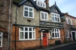
| Fox & Roman Public House and outbuildings (originally The Fox) | Tadcaster Road View on map |
1900 | There has been a pub on this site since at least 1822, originally known as the Fox Hotel. The present building by Samuel Needham was built for the Tadcaster Brewery Company in 1900. The name was changed to Fox & Roman to commemorate a Roman grave found on the site in 1998. The building still retains original internal and external features, like the half-timbered frontage and balustraded balcony. The outbuildings with original half doors, were formerly used for stabling racehorses. The public house has great historic significance due to its association with the races, and unique evidential value through its association with Roman remains. It is still a favoured communal asset. (HER no. MYO4030) |
| Cross Keys Public House – Outbuildings | Tadcaster Road View on map |
Early 18c | Remains of once extensive stabling. Evidence of the importance of Dringhouses to the racing world. There has been an inn on this site since before 1250 |
| Springbank, 128 Tadcaster Road | Tadcaster Road View on map |
1924 | The grand house with extensive gardens was designed in 1924 by A.J. Penty for Mr T. Shouksmith, the longest-serving chairman of a prominent York engineering company. The original drawings of the building are in the Brierly Archive at the Borthwick Institute. The house has aesthetic value, framing the Tadcaster Road Conservation area and historic value, being linked to a prominent York architect. (HER no. MYO4031) |
| Homewood, 40 The Horseshoe | The Horseshoe View on map |
1928 | Built for W. T. Forsselius by Brierly and Rutherford. A house of real character. (HER no. MYO4032) |
| Marriott Hotel (Swallows Hotel) | Tadcaster Road View on map |
1876 | The hotel was originally constructed in 1876 as a residential building for the York businessman and alderman John Close, who required his house to be close to the new Railway Station. Nicknamed ‘The Hollies’, the house overlooks the racecourse and Knaversmire and soon earned the tile of the gateway to York as well as became the terminus for the Dringhouses tramline. It was first transformed into The Harkers Hotel in 1927 before being renamed the Chase Hotel in 1948 and most recently it was acquired by Marriott International in 2001. Many original features of the house remain, such as the Close family horse stables that are now the hotel’s management centre. The rear garden contains elements of the original design with path edges and steps in wrought iron. The landmark building signifies the development of the Dringhouses area and has great historic value, being linked to an influential York family. (HER no. MYO4033) |
| Part of St. Leonard’s Hospice | Tadcaster Road View on map |
Pre 1889 | St. Leonard’s Hospice has incorporated the ancillary buildings (cottage and stable) of a large late-Victorian house named ‘Dringthorpe’. The grand house was home to many affluent middle-class families, before becoming a school for the blind in 1950. The main house was demolished in 1965 and St. Leonard’s Hospice was built on part of the grounds, with the rest of the grounds later used for residential development. The surviving cottage and stable block give an impression of the main house, with ornate chimneys, roof tiles and bargeboards. The buildings hold high aesthetic and historic value, increasing our understanding of the area and acting as reminders of the lost Victorian villa. (HER no. MYO4034) |
| Circular Iron Fence at St Leonard's Hospice | St Leonard's Hospice, Tadcaster Road View on map |
Pre 1892 | St. Leonard’s Hospice has incorporated the ancillary buildings (cottage and stable) of a large late-Victorian house named ‘Dringthorpe’. The grand house was home to many affluent middle-class families, before becoming a school for the blind in 1950. The main house was demolished in 1965 and St. Leonard’s Hospice was built on part of the grounds, with the rest of the grounds later used for residential development. The surviving cottage and stable block give an impression of the main house, with ornate chimneys, roof tiles and bargeboards. The buildings hold high aesthetic and historic value, increasing our understanding of the area and acting as reminders of the lost Victorian villa. (HER no. MYO4034) |
| Wind pump tower | Moor Lane |
19c | There is little remaining evidence of the buildings connected with the brickwork sites in Dringhouses. The Wind Pump Tower with some internal planking by Pearcy’s Pond is the sole remaining structure from these days. The tower would have had sails similar to a windmill and operated a water pump to keep the clay workings dry. All the Claypits used these windpumps and can be seen on maps as late as the 1930s. The flooded claypits and their surroundings now provide valuable havens for wildlife and recreational areas for locals. The site holds high historic significance due to being a rare example of the brickmaking industry in the area. (HER no. MYO4035) |
| No. 92 Tadcaster Road | View on map |
c1892 | The detached house along Tadcaster Road with square bay windows and decorative wall tile hanging was built in the 1890s. The vertical tile hanging style was used widely in the late 19th and early 20th century under the influence of the Arts & Crafts movement and the Queen Anne revival, mainly in South-Eastern England. The building lines the Tadcaster Road conservation area and is a good and rare example of this craft in Dringhouses. (HER no. MYO4037) |
| Methodist Chapel | Tadcaster Road |
1896 | Methodism was introduced locally in 1816 and the original Methodist Chapel was built in 1834 on the corner of Slingsby Road and Tadcaster Road. This was replaced by a larger building, known as Dringhouses Chapel in 1890 on the same site. It later became part of the new, enlarged York, Wesley Circuit of the Methodist Connexion. The chapel was closed in 1954 and the congregation transferred to the new West Thorpe Chapel on West Thorpe Road. It has since been turned into an office space, however, it is still recognisable and has high social-historic value due to its religious connections. (HER no. MYO4038) |
| Racing Stables | Tadcaster Road View on map |
1922/1930 | Four quadrangles of 48 stables each along Tadcaster Road were constructed by the York Race Committee from 1922 to 1930 and are still in use. Two to the East was designed by renowned York architect W. H. Brierley in 1929 and remains his only example of this type of building. One stable to the SW contains a bowling green used by Dringhouses Bowling Club, opened by Noel Terry in 1929. Some original fittings remain although most of the stable doors were replaced when Royal Ascot came to York. The stables were a designated mortuary in WW2, commemorated by a plaque. They are of historic significance due to their connection to the racecourse and have high community value being home to a historic bowling club. |
| Astonthorpe House, No.s 308-312 | Tadcaster Road View on map |
1901-1905 | The traditional late Victorian townhouse built in the early 20th century is a notable rare local example of the work of the Arts and Crafts architect Fred Rowntree, the second cousin of Seebohm Rowntree. The building is of pale brick with red brick dressings and stone-mullioned windows and contains a grand staircase. The townhouse has had sympathetic extensions, as it was used as an office space in the late 20th century and later converted into flats. Along with No. 310 and 312 Tadcaster Road, the houses are fine examples of turn-of-the-century English domestic architecture. Together they mark the extension of the City of York adding character along Tadcaster Road towards the village of Dringhouses. (HER no. MYO4039) |
| Knavesmire & Hob Moor boundary fence | Tadcaster Road View on map |
Hob Moor and Knavesmire were ancient pastures of the city: their low-lying, marshy nature probably prevented any early settlement, thus they were used as common grazing land, where freemen of the city were able to exercise their rights to pasturage. The boundaries of the two strays were first accurately surveyed in the 1850s. The surveyors found the boundary along Hob Moor Lane undefined, thus drawing a straight line along it to the Tyburn and south along Tadcaster Road to a boundary stone at what was then called Tyburn Lane. The white-painted secure boundary complete with wide gates and kissing gates was a later addition. The historical boundaries play a key role in explaining the development of the area and enhancing local distinctiveness. It is a reminder of the land's original use, as the strays were used for grazing until the 1960s. (HER no. MYO4040) | |
| No 1 Railway View | Railway View View on map |
In the 1920s there were already two taverns in Dringhouses, but despite the villager's objection, William Wilkinson was granted a licence to open a third one, naming it the Turf Tavern. Due to the complaints about the noise and disturbance from the residents at The Hollies, the tavern was forced to move in 1897. The reopened Turf Tavern occupied the newly built end of a terrace on Railway View. It was popular with the locals and due to the number of new housing developments it became too small to cater for everyone. Thus the Tavern moved again in the mid-1950s to Thanet Road and was eventually demolished in 2014 to make way for housing. No 1. Railway View became a greengrocery and later a corner shop until it was turned into a residential property in 1999. The building has historic and communal value due to its unique history and importance as a local tavern. | |
| Group of cottages | Old Moor Lane View on map |
19c | This group includes the signalman’s cottage for the level crossing named “Chaloner Whin Gate” which used to cross Moor Lane. They are part of railway history as the road was realigned when Moor Lane railway bridge was built, leaving a cul-de-sac. (HER no. MYO4042) |
FISHERGATE
| Site | Address | Date | Description |
| The Gimcrack Hotel and Coach house | Fulford Road View on map |
1850/1860 | Believed to have been built around the mid-Victorian era, The Gimcrack Hotel and Coach house is a villa situated along the Fulford Road conservation area. Originally a private residence called Ousefield, it opened as a public house in 1936 with connections to the horse racing around the area. The building operated as such until 2002, despite local opposition. Made of white brick with hipped roof slate, the Victorian villa adds elegance to the area. Since its closure, the Gimcrack Hotel has been converted back into residential use but still has retained its previous elegance and connection to horse racing through a pub sign that has been renamed Fulford Chase. (HER no. MYO4018). |
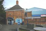
| Fishergate Post Office | Fulford Road View on map |
1930’s | 115 Fulford Road is an example of fine mid-1930s architectural design. The windows along the front elevation appears to be a mix of sash windows with a semi-circular top. A small post box is located to the right of the front door, indicating that the building was used as a post office. The characteristics of the house adds to the local street view along Fulford Road. Fulford Road is a historic road with a mix of Victorian up to 1930s styled houses and is part of the Fishergate Conservation Area. (HER no. MYO4015). |
| Tower House | Fishergate View on map |
1878 | Originally built for the War Office in 1878, the Tower House is a large Victorian Gothic-styled building located on the corner between Fulford Road and Winterscale Street. Made of red brick in Tudor style, the Tower House is a Building of Merit in the Historic Core Conservation Area Appraisal. The building was converted for military use for the Northern Command during the Second World War and was used as their headquarters with the inscription "Headquarters Northern Command" carved above the main doorway. The clock tower has retained its original winding gears. The Tower House is situated on top of a Roman burial ground. The building is currently being used as a business centre. (HER no. MYO3955) |
| Fenby Field | Cornwall Drive View on map |
1927 | Fenby Fields is a recreational ground accessible from Cornwall Drive. Originally purchased in 1927 by NYCC as school playing fields, the fields were used by several school within the area, including both Fishergate and St. Georges. The area has become an environmentally friendly rural park where locals still use the fields as a recreational space and is included in many walking guides around the Fishergate/Fulford area. (HER no. MYO4044). |
| 79 Fulford Road, Pipkins Nursery | 79 Fulford Road View on map |
1879 | Formerly Pipkins Nursery, the stone arcade which stands along Fulford Road was once part of York Theatre Royal circa 1835. Believed to have been designed by architect John Harper, the three-stone arches formed part of a colonnade for the newly built York Theatre Royal. In 1879, the theatre underwent remodelling, removing much of the original fabric, which included the colonnade. The arches were salvaged by local merchant Isaac Poad to decorate the front of his new stable and coach house complex on Fulford Road. The arches are a unique element to the streetscape along Fulford Road. (HER no. MYO4045). |
FULFORD AND HESLINGTON
| Site | Address | Date | Description |
| Alfreda, No 61 | Heslington Lane View on map |
Late C19th/early C20th | 61 Heslington Lane, also known as Alfreda, is an Edwardian house which has been internally altered throughout the years but has retained its original exterior. The building sits within the eastern fringe of the Fulford Conservation Area and is of historical and political importance within the area. Alfreda has been home to many civic leaders and a cabinet minister in Tony Blair’s first administration over the years. The building has now been sympathetically converted into flats. Along Heslington Lane are several Victorian and Edwardian houses that contribute to the street scene in Fulford, including No. 61. (HER no. MYO4046). |
FISHERGATE
| Site | Address | Date | Description |
| Copper's Lodge | Alma Terrace View on map |
1880 | 28 Alma Terrace, formerly known as Copper's Lodge, was a late 19th century police station. Built for the East Riding Constabulary, it originally a Charge-room, three cells and two dwelling houses for resident police officers. After 1884 it became the base of Fulford fire engine. The building is representative of a crucial phase in the expansion of York during which the Imphal Barracks were enlarged (1877/80) and associated development along Fulford Road brought about its incorporation into the City of York in 1884. The building was built to maintain order within the expansion of terraced housing within the area and was a convenient distraction for the soldiers stationed at the nearby barracks. The site was converted into a guesthouse in the late 1970s and is now private residential housing. The building is made of attractive solid red brick and is nearly symmetrical with arched windows and decorative chimneys and sits prominently on the street corner, adding to the local street view. (HER no. MYO4016). |
| Fairfax House | Heslington Road View on map |
1925/1933 | Built circa 1925 by Chapman & Jenkinson, Fairfax House on Heslington Road was originally a home for the nurses working at The Retreat located nearby. The house is of a William and Mary style with tall, pale brick ranges and darker brick dressings. There are pedimented gables along the top and features round headed windows all around the property. Fairfax House is now student accommodation and a part of Vanburgh College at the University of York. (HER no. MYO4047) |
| Alma Grove | Alma Terrace View on map |
1910 | Alma Grove plays an important role in the development within the Fulford Road Conservation Area. Dating to 1913, Alma Grove is an early example of social housing purposefully built originally for York Corporation tram workers. This development was where York's first council houses were built and is a fine example as such. Alma Grove was built around a green square space and the area has retained their original signage. Potentially could be the outcome of Rowntree's social reform in York during the turn of the 20th century. (HER no. MYO4017) |
| Old Off Licence | Ambrose Street View on map |
About 1870 | 90-92 Ambrose Street sits on an end terrace location, with Holly Terrace located to its left. The building was built in 1870 as an off license and was originally owned by Samuel Smith's Brewery until it was sold in the 1950s and turned into private residential dwellings. The white stone lintels around the windows and doorways are distinctive and appear to be present among the other Victorian terraced houses along Ambrose Street. A sign for 'Samuel Smith's Taddy Ales' used to hang outside of the property but this has since been removed. (HER no. MYO4048) |
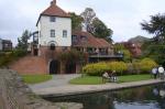
| Watergate | The New Walk View on map |
1924 | Built in 1924 in rare late Tudor Revival Style, prominent on the river frontage because of its forward, elevated position. The design presents an asymmetrical arrangement of symmetrical parts, projecting eaves, fake timber framing, leaded lights and a steeply pitched roof, all contributing to a dramatic silhouette. Built on the site of the original coach house of the Grange, it was extensively remodelled and modernised in 2006. Grade II listed. (HER no. MYO4049). |
| Beechwood House (Tower Vets) | Fulford Road View on map |
c 1870 | Beechwood House is one of several Victorian villas built along Fulford Road between 1867 - 1871. Originally owned by Richard Jackson, a wool merchant and farmer from Cawood, it later became the residence of a successful provision merchant, Isaac Poad during the late 19th/early 20th centuries. Poad’s stable and coach house was also situated along Fulford Road and the stone arcade he had salvaged from the York Theatre Royal is also included on this list (see Pipkins Nursery). Isaac Poad’s seed and grain business still exists today as Isaac Poad & Sons Ltd. The Victorian villa is the furthest south of the series of villas along Fulford Road and is almost square in shape. The front elevation has a double bay window facing the road and a further bay window and entrance facing the south. Tower Vets are the current occupants of the house, and the house is aesthetically pleasing. (HER no. MYO4050) |
| Hollycroft | 20 Wenlock Terr. View on map |
Mid 19c | Hollycroft is a mid-19th century Victorian villa situated on the north side of Wenlock Terrace, near the historic Fulford Road and is within the Fishergate Conservation Area. The area which the house now stands is believed to have been where a former nursery in the early 19th century once stood. There are also ties to the military barracks, especially during the First and Second World Wars where several houses on the terrace housed soldiers. Hollycroft has two bay windows on the ground floor of the front elevation and single pane sash windows along the first floor. The stone lintel above the door is decorative with a semi-circular fanlight. A simple cornice, similar to Holly Lodge, runs underneath the roof. Hollycroft is attractive and adds to the Victorian streetscape of Wenlock Terrace. |

FULFORD AND HESLINGTON
| Site | Address | Date | Description |
| Sir John Hunt Memorial Homes | Fulford Road View on map |
1954 | An attractive group of red brick and tiled terraced almshouses built by Needham, Thorpe & White in 1954. Sir John Hunt was a wealthy brewer and landowner who died in 1933. In his will, he made provisions of the founding of the almshouses should his son Reginald die without a son. After Reginald and his sister Violet die childless, the almshouses were built on part of the Fulford Park Estate. The almshouses accommodate for the most vulnerable members of society. (HER no. MYO4051) |
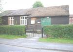
| Fulford Social Hall | School Lane View on map |
Mid 19c | Built in 1865, the social hall was originally an extension to the old St Oswald's school. In the 1930's, the school moved to a new premises, and the social hall was a printing works. During WWII, the building became an ambulance station and a first aid centre. Fulford Parish Council bought the property after the war and used it as the village's library until 2006. Some alterations have been made to the social hall so it could accommodate a community space. (HER no. MYO4052) |
GUILDHALL
| Site | Address | Date | Description |
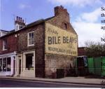
| Bile Beans Advertisement Mural | No. 18 Lord Mayor's Walk View on map |
Advertisement painted on the side elevation, indicating that: “Nightly BILE BEANS keep you Healthy, Bright-eyed and Slim”. Probably dates from the 1940’s and the demolition of adjacent buildings. Included in the List as an example of early 20c advertising and as a colourful and valued contribution to the local street scene. From the 1950's onwards mass printed posters and billboards were fashionable and so it was covered during the 1960's with a hording advertising cigarettes until it was uncovered again in the 1970's. It has been repainted on 2 occasions. |
MICKLEGATE
| Site | Address | Date | Description |
| Botterill's Warehouse | Tanner's Moat View on map |
c1880 | Originally built by W. G. Penty to accommodate horses and carriages of country visitors to the City (especially members of the Yorkshire Club). Originally 3 stories tall. By the 1950's it was used for monthly horse auctions. Most of Botterill’s was demolished in the 1960’s and replaced by Leedhams Garage. The entrance block survives next to the Maltings pub and is included in the list as a reminder of the precursor of car parks and when colourful polychrome buildings were at the height of architectural fashion. The remaining structure is the ground floor frontage and consists of two ornate archways built in a "Moorish" style with decorative red and white brickwork. The upper stories and gable were removed and replaced with a flat roof extension. (HER no. MYO4008) |

GUILDHALL
| Site | Address | Date | Description |
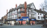
| White Swan Hotel | Piccadilly View on map |
1912 | The hotel was built in 1912 when Piccadilly was created by opening up a gap in a row of medieval buildings linking Coppergate and Pavement. At that time the old White Swan was demolished and its name and function transferred to the new hotel built on the newly formed corner of Coppergate and Piccadilly. It directly marks an important improvement in the creation of the new street and is included in the list for that reason. It also fits well with the adjacent medieval buildings in Coppergate and into the Piccadilly street scene, occupying suitably the space for which it was designed. After closing in the 1980s the building stood empty for decades before being briefly squatted and renamed the Rainbow Peace Hotel in 2003. Renovation started 2014 and in 2015 the building reopened as a bar called the Pavement Vaults with apartments above. (HER no. MYO4004) |
| Banana Warehouse | 36 Piccadilly View on map |
1925 | One of the first buildings to be built along Piccadilly in 1925. A purpose built fruit store with refrigerated storage and ripening room built for F T Burley, wholesale fruit merchants and banana specialists. Included in the local list because it represents the 20th Century development of Piccadilly and the River Foss as an industrial and commercial area. As the most recognisable Art Deco building in the City, it is one of a decreasing number of inter-war buildings in York. It sold antiques and bric a brac for 20 years until 2016. |
| Minster Inn | Marygate View on map |
1903 | A public house designed by Samuel Needham for Tadcaster Tower Brewery. A fine example of a purpose-built Edwardian pub, with original windows and interior tiling, its three original rooms preserve their bench seating and other original features. It is on CAMRA’S List of Historic Pubs in York. Renovations in 2016 to meet fire regulations have resulted in the loss of some interior features, including original doors and a 1950's fireplace. (HER no. MYO4002) |
HAXBY AND WIGGINTON
| Site | Address | Date | Description |
| Memorial Hall | The Village, Haxby |
1876 | Village school and schoolmaster's house built in 1876. It served as the village school until 1954 when it was replaced by the Ralph Butterfield school. At this time it became the village hall and was renamed Haxby Memorial Hall to commemorate the dead of two World Wars. It is important for its contribution to the variety of the village street scene and is one of the individually important buildings identified in the Conservation Area description of Haxby. Included in the list for these reasons; and also as a memorial to those from Haxby lost in two World Wars; for being a tangible link with the Victorian history of the village; and for its place in the social history of the village, recalled with affection and valued by many who attended when still a school. (HER no. MYO4104) |
| Wind Pump | 103 York Road View on map |
A 20 feet high brick structure with remains of woodwork and iron machinery, associated with the workings of the former brick pond. Of historic interest to the area. (HER no. MYO4105) | |
| Primitive Methodist Chapel | The Village, Haxby View on map |
1867 | The building is the only remaining evidence of the Primitive Methodist movement in Haxby. Its modest proportions indicate the relative poverty of its members. Although large wooden doors have been added the remainder of the building is intact and in good condition. An excellent example of decorative brickwork typical of Primitive chapels. Part of the local street scene. (HER no. MYO4106) |
FULFORD AND HESLINGTON
| Site | Address | Date | Description |
| 1 & 2 Woodyard Cottages | Main Street Heslington View on map |
Late 18c | No. 1 & 2 Woodyard Cottages were built during the late 18th century. The two cottages have a mix of 12 and 18 pane sliding sash windows on the frontage with one door placed at the front of one of the cottages. The cottages contributes to the street scene in the Heslington conservation area. |
| Hawthorne Cottage Heslington | Main Street View on map |
19c | Hawthorn Cottage was built in the 19th century and is a fine estate worker's house with period additions. The cottage still has its original 16 pane sash windows along the first floor frontage. Contributes to the streetscape in a conservation area. |
| Keepers Cottage Heslington | Main Street View on map |
Late 19c | Built in the late 19th century, Keeper's Cottage is a fine example of a Victorian estate worker's cottage. The cottage has retained its original fenestration and has a mix of 6 and 12 pane sash windows, adding charm to the village conservation area. |
| Bridge Farm Heslington | Main Street View on map |
?18c | Bridge Farm is a traditional Georgian farmhouse which has three 4 pane sash windows. The farmhouse contributes to the aesthetic of the village's street view and conservation area. |
| Memorial Cottages Heslington | Main Street View on map |
1903 | A row of four late Victorian almshouses dedicated to Lady Deramore by her husband Lord Deramore. A central pediment is located above the front doors to cottages 2-3 with a stone in memoriam in the centre of this pediment. These cottages were built was 1903 and there is great detailing on the doors and eaves of the properties. The cottages are attractive, contributes to the village streetscape and are a fantastic example of early 20th century almshouses. |
| The Pinfold Heslington | 29 Main Street View on map |
18 & 19c | The Pinfold is a fine example of a Georgian estate house. The cottage appears to have been built next to a pinfold (well) and is situated near open fields. The cottage has retained its original 16 pane sash windows and contributes to the street view of the village conservation area. |
| Vyne Cottage Heslington | 30 Main Street View on map |
Late 18c | Vyne Cottage, similar to The Pinfold, is a Georgian estate worker's cottage. The cottage has its original sash windows, with 16 pane sash windows at the bottom and 12 pane sash windows at the top of the front elevation. The cottage enhances the streetscape of the village conservation area. |
| No 31 & 32 Heslington | Main Street View on map |
18/19c | A row of traditional Georgian terraces cottages once used to house estate workers for the surrounding farmland. The cottages have retained their original 12 and 16 pane sash windows and contributes to the aesthetic of the village conservation area. |
| Lowfield House Heslington | Main Street View on map |
19c | Lowfield House is a mid-late 19th century cottage that incorporates Georgian styles into its design. The 16 pane sash fenestrations around the property are original and adds to the street view at the southern end of the village. |
| No.s 35 & 37 | Main Street View on map |
18c | A terrace of traditional 18th century cottages situated on Main Street. The front elevation consists of six 16 pane windows, two for each cottage, and three 4 panelled doors with transoms. Contributes to the street view within the conservation area. |
| No.s 38 to 40 | Main Street View on map |
19c | A row of Victorian terrace estate cottages. The cottages have retained their original sash fenestrations and contributes to the street view in the village's conservation area. |


HEWORTH
HEWORTH WITHOUT
| Site | Address | Date | Description |
| Brick Pond (Bulmer’s Pond) / Wind Pump | Willow Grove View on map |
1700’s | Evidence of early suburban development methods, and now an area of local natural interest and a valuable local nature reserve, with remains of an EH-listed wind pump. (HER No. MYO656) |
HOLGATE
| Site | Address | Date | Description |
| Iron Foundries | Off Leeman Road View on map |
1872/3 | Buildings of the Phoenix the Albion Iron Foundries now used as workshops and storage sheds for Network Rail and the Post Office. Buildings date from 1872/3 when the two foundries moved from separate sites in the city centre to adjacent sites close to the North Eastern Railway Company operations. In 1880 the two combined to form the York Engineering Co. The surviving complex consists of six brick buildings which include the office block of the original Albion Works, the foundry, smith’s shop, machine shop and part of an original Phoenix building. The foundries produced a variety of cast and wrought iron components for the construction of the expanding railway infrastructure such as columns, girders, roof trusses for stations and workshops, bridges, lamp standards and so on. The buildings survive as the only significant reminder of a crucial aspect of York’s industrial history. HER No : MY02178 Phoenix foundry demolished November 2012 |
| Terrace houses, Carlisle St and Carleton St | Carleton Street & Carlisle Street View on map |
Two terraces of houses dating from 1873, providing housing for the workers of the Albion and Phoenix Iron Foundries located at the southern end of the streets which produced iron components for the expanding railways of York. As an integral part of the adjacent foundry complex, they are a rare and unexpected survival of part of York’s nineteenth-century industrial history. (HER nr. MYO4061) | |
| Canteen Building | Carriage Works View on map |
1888 | Formerly known as the Mess Room, the Canteen Building was built in 1888 to serve the workforce of the carriage works which opened in 1884. It is the last remaining work-specific social building in the carriage works complex and York's railway heritage more widely. The Canteen is of architectural interest as it shares common design motifs with the Carriage Works themselves as well as other rail structures in the city, such as the Railway Institue buildings. These include the round windows below the apex of the gables, sawtooth brickwork at the top of the gable, and arched ground floor window. According to architectural plans dated to 1887, the canteen was well provisioned with modern facilities, including serveries, heating, and indoor lavatories. As the rail industry boomed, the site expanded, including the addition of a Time Office near the Canteen and, in early-C20th, an extension to the Canteen and a purpose-built bicycle house. Following the introduction of women into the industrial workforce during and after WW1, the Canteen was further expanded and furnished with new women’s WCs. (HER no. MYO3766) |
| Balfour Street Play Area | Off Salisbury Terrace |
1911 | Gifted to the City Council by S.A. Rowntree as a green recreation area. It contains a seated garden area and some trees. Used by residents of the gardenless local terrace houses and by children as a peaceful area away from the road. (HER no. MYO4066) |

HUNTINGTON AND NEW EARSWICK
| Site | Address | Date | Description |
| Memorial Hall Huntington | Huntington View on map |
1921 | Purchased by subscription, an aspect of social history, of architectural interest. Managed by trustees and volunteers, an important community asset. (HER no. MYO4063) |
| Huntington Community Centre | 28 Strensall Road View on map |
1877 | The Old Board School is one of the oldest public buildings in Huntington. Owned by the Parish Council it is used for a number of activities. Many original features including recently restored stained glass windows. (HER no. MYO4062) |
MICKLEGATE
| Site | Address | Date | Description |
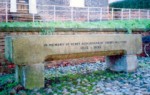
| Drinking trough | Bishopgate Street View on map |
1905 | A horse through now filled with flowers, with an inscription that reads “In memory of Henry Richardson of Cherry Hill, York 1813-1895”. Richardson was bequeathed a tannery on Cherry Hill by his father and in the latter half of the 19th Century started manufacturing chemical fertilisers. Richardson’s factory was situated just south of Skeldergate Bridge along the Ouse frontage. It was closed in 1973 and demolished soon after. Richardson was also a co-founder of the York branch of the RSPCA in 1864. In respect of this, on the reverse, the inscription reads “A righteous man regarded the life of his beast”. It is a memorial to a respected pillar of the local community and a reminder of the lost industrial past in the area. (HER no. MYO4065) |
| The Slip Inn | Clementhorpe View on map |
1840 | This early 19c pub sometimes mislabelled as ‘the Ship Inn’ is an important reminder of the boat-building industry in the Clementhorpe area, and the presence of the old slipway (a ramp that allows a ship to be moved to and from water). The original pub was opened in 1836, however, it was recorded as having been rebuilt and owned by the Tower Brewery Co. of George Street in 1902. The building incorporates an existing cottage located at the rear of the pub related to the shipyard. The ‘Slip’ is mentioned in Hugh Murray’s book “Directory of York Pubs”. It has high community significance and was voted CAMRA’s York Pub of the Year in 2020. It has considerable historical and evidential value, being one of the last remainders of the boat-building industry in York. (HER no. MYO4064) |
| Paved Walkway | Terry Avenue View on map |
? 1900 | This paved walkway is part of the New Walk/Terry Avenue Conservation Area that follows the line of an 11th-century dam across the Foss. It is a popular riverside walk that incorporates the natural form of the river and the planned landscapes that border it on each side. The paved walkway was a pleasant path laid in diamond pattern sets, right alongside the river at a similar level to the lower path on the opposite bank at New Walk, however, the bank slippage has obscured much of it and it is partly concreted over. (HER no. MYO4068) |
| Railway Institute Buildings | Queen Street View on map |
1879 & 1884 | The two parallel ranges adjacent to the Railway Institute were constructed as Locomotive Erecting Shops for the North Eastern Railway Company. The block nearest the RI incorporates the remains of a North & North Midlands wagon repair workshop of the 1840s. This was extended in the 1850s and a smith’s shop was added, to provide workshops for the newly formed North Eastern Railway Company. Around 1884 the building was raised and converted to provide the No.2 Locomotive Erecting Shop where the locomotives were repaired and sometimes constructed. The second block was purpose-built as No.1 Locomotive Erecting Shop in 1879. As the use of the educational facilities at the RI decreased and demand for physical activities increased, the redundant carriage-building shops were converted into a gymnasium in 1926. The old carriage works were predominantly used as a boxing ring but today they host nine wood-sprung badminton courts. These blocks of workshops are rare survivals of a considerably larger group of buildings which represent the development of the railway industry in York during the nineteenth century. Furthermore, the buildings have been at risk of demolition due to the York Central Development, despite their communal and historic value. (HER no. MYO3795) |

HOLGATE
| Site | Address | Date | Description |
| Alliance House | York Carriage Works View on map |
Opened 1884 | Alliance House is the name given in 1996 to a block of buildings at the N.E. end of the former Carriage Works. Part of the first phase of development of the N.E. Railway's new carriage workshops & designed by their architect William Bell. Originally an extensive general stores, with, at the N. end a 3-storey range for the works offices, the top floor housed the drawing office and was provided with large north-facing windows. The origin stores building was later converted to to house modern offices for the carriage works. The building has high Historical Significance representing a major part of York's heavy industrial history, and a High Communal Significance encompassing an era of more then 150 years during which many York families earned their livelihoods from the construction & maintenance of locomotives, wagons and carriages in the City. (HER no. MY03790) |

MICKLEGATE
| Site | Address | Date | Description |
| Railway Institute, 22 Queen Street | Queen Street View on map |
1889 | York Railway Institute built in 1889, “to convey information and spread education on a variety of subjects”. From the beginning, it has offered educational facilities for railway The York Railway Institute was built in 1889 at the site of the old Railway Tavern, “to convey information and spread education on a variety of subjects”. From the beginning, it has offered educational facilities for railway employees, with a well-stocked library and reading room, a dining room that could seat 400 people, three classrooms, as well as a games room for cards and billiards. It has fulfilled a social and welfare function by providing accommodation for a wide range of recreational activities, associations and clubs. It is included because of its unbroken connection with the railway history of York and for its important contribution to the education and well-being of the railway workforce and the wider public in York. Moreover, it still holds communal value today, being a large sports club with over 3000 members, and hosting an array of events. Almost contemporary with the building of the present York railway station, it forms an important part of the setting of this grade II* listed building. (HER no. MYO3983) |
| Ivy Cottage | Queen Street View on map |
Between 1875 & 1892 | The Ivy Cottage was a Shunter's cabin, for railway workers moving trains between yards and platforms for the original York Rail Station. When the new station opened in 1877, the old trainsheds remained carriage sidings, used for storage and maintenance. The Ivy Cottage became the locking fitter's cabin, for the signallers to ensure that there would be no conflicting routes. The Old Station along with the Ivy Cottage remained in use til 1966, to accommodate car-carrying services. Along with the now unrecognisable Old Railway Station, the building is indicative of the alignment of the original railway and reflects later arrangements after the construction of the New Station. It has historical and evidential significance as a reminder of the development of the rail industry in York. (HER no. MYO4007) |
| Park Keeper's Lodge and Cafe | Rowntree Park, Richardson Street View on map |
1919/21 | Designed by Fred Rowntree who made the plan for the layout of the Park. The tall 4-storey building occupies a prominent position from where the resident park keeper was able to supervise activities in the Park. The upper floors consist of two storeys of living accommodation historically meant for the park keeper, and the lower floors are used for a cafe and storage space. It holds high community value, being used by York Explore as a popular Reading Cafe, with further plans to develop the now vacant living spaces into a communal haven. Together with the nearby bridge over the lake and the Dovecote, the Lodge creates an important group forming the nucleus of the Park. Moreover, the elevated position offers landmark views of the park. (HER no. MYO4069) |
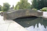
| Bridge over the Lake, Rowntree Park | Rowntree Park View on map |
1921 | The hump-backed bridge with brick parapets crosses over the long serpentine lake, leading to the timber-framed and brick gatehouse building, known as the Lych Gate (Grade II). It was likely designed by Fred Rowntree along with the rest of the park. Together with the Lodge, Café and Dovecote above Lych Gate, it forms an important group of structures at the core of the Park. It offers views across the lake and is a popular birdwatching spot. (HER no. MYO4071) |
| Knavesmire Glass | 88a South Bank Avenue View on map |
1900 | The building has a memorial stone from 1900 dating from when it was constructed as the South Bank Mission Chapel to help with the rapid expansion of the Bishopthorpe Road area. This was an outreach centre from the larger church of St. Clements, Scarcroft Road until the construction of St Chad’s on Campleshon Road. It was a multi-purpose building functioning as a place of worship, as a temporary school in 1906, as a Sunday School in 1931, as well as for Mothers’ Union meetings. Since the 1960s it has been used as a warehouse housing glaziers. It is a typical building from the era, similar in style and materials to St. Clements, though plainer with simpler detailing. The building has local historical significance as an indicator of the early 20th-century development of South Bank. More importantly, it adds variety and depth to the context of terraced housing. It is a significant building of local visual, historical and architectural interest. (HER no. MYO4072) |


ACOMB
| Site | Address | Date | Description |
| Carlton Tavern / West Garth | York Road View on map |
Late 1880's | A Victorian villa named West Garth that was originally owned by the Russell family. From 1945 to 1970 it was the Godfrey Walker Children's Home that had moved there from West Bank Terrace. It became a hotel and in 1993 was bought by Marston's Brewery when it became a public house. It is the last of the four grand Victorian/Edwardian villas that were once seen along Acomb Road. It has been under threat of demolition and its loss would diminish the character of the area. It has great historic, aesthetic and community significance due to its use as a children’s home and later a popular public house. (HER no. MYO4300) |
HOLGATE
| Site | Address | Date | Description |
| Upper St Paul's Play Area | Upper St Paul's Terrace View on map |
1970's | Garden and play area of about 1/2 acre created in the 1970's by CYC after housing within the Clearance Area was demolished, to balance a lack of green space within the area. It was given open space approval in December 1979. Maintained by local residents with Council help. Funded by both Ward and local donations it is used for social and recreational purposes, particularly by children. Events such as basketball, picnics, scarecrow competitions are held there and it is also used by the local school. On City of York asset register property ref.200004776489 |

MICKLEGATE
| Site | Address | Date | Description |
| Church Hall | Bishophill Junior View on map |
Possibly 1880 | This Mid-Victorian church hall is constructed in deep red brick with a Welsh slate room. It was possibly designed by James Demaine along with the Vicarage during the restoration of St Mary’s Church. It has since been used as a Church Hall, Sunday School and more recently a Dance Academy. Known as Mary Mac’s, it was an incredible community asset before being converted into a private dwelling in 2010. It still holds high aesthetic value, being part of the group of three attractive buildings along with St Mary Bishophill Junior and the Vicarage. (HER no. MYO4005) |
| Boundary Stone | GR 590498 |
Pre 1852 | Magnesian limestone, possibly once inscribed near the corner of the Marriot Hotel boundary wall. Historically boundary stones mark the start of a land boundary or the change in a boundary, especially a change in direction of a boundary. There are two other boundary stones nearby that are Grade II listed, marking the division of Hob Moor and the Micklegate Stray. (HER no. MYO4073) |
| Flight of steps with railings and posts | Albemarle Road, Opposite Scarcroft Allotment entrance on Albemarle Road |
Part of the access route from Nunnery Lane through Scarcroft Green and the allotments to the Knavesmire. The historical boundaries play a key role in explaining the historic development of the area and enhancing local distinctiveness. They have communal value, providing access to a large, important recreational space. They have survived the introduction of the cycle route. (HER no. MYO4075) | |
| Former WWll Air Raid Shelter | Albemarle Road View on map |
c1939 | The original brick-built air raid shelter was built between 1939 and 1945 by the War Department under the auspices of the Defence of The Realm Act 1914. After the World War, it found use as a changing room for the Ovington Cricket Club and the Alliance Cricket Club until the latter relocated to Clifton Without. In 1991 the Ovington Cricket Club was granted permission to extend the building to the west to create a veranda and cover the building with a pitched roof. It is still in use by the expanding club, with plans to further extend it. It is historically important, serving as a reminder of the last War and one of the very few examples of air raid shelters remaining in York. Its later use by the cricket clubs demonstrates its valuable role in the local community. (HER no. MYO4076) |
| Water Trough | Knavesmire |
19c | A water trough for horses and cattle with no inscription on it. It is a historical reminder of how this space was used throughout the medieval period when it was a common grazing land. (HER no. MYO4077; GR 591499) |
RURAL WEST YORK
| Site | Address | Date | Description |
| 5 cottages Buttacre Lane | Askham Richard View on map |
C19 | A row of 5 pretty terraced cottages built between 1900 and 1929 to house agricultural tradesmen such as the blacksmith. These were built on the site of poor houses. Constructed from red brick with red pan roof tiles, each house has a tall arts and crafts style brick chimney with three chimney pots each. Part of Askham Richard Conservation Area. (HER no. MYO4141). |
| Dovecote, Old Barn | Prospect Farm Askham Richard |
Dovecote in the gable end of the Old Barn. Dated to late 19thC early 20thC. It survives complete and retains its interior with nesting boxes intact. Included in the Local List as a rare survival of a one common component of a fully developed farmstead. As a feature in the farmyard, it is much valued by residents in the village. (HER no. MYO4140) | |
| Tap Room | Askham Richard View on map |
Roof supported by 4 pillars over tap (originally pump) on village green erected by the owner of Askham Grange. (HER no. MYO4140) | |
| Wall beside barn, Prospect Farm, Mill Lane | Askham Richard View on map |
?18C | Coarse cobble layers with herringbone laid bricks topped with rounded coping stones, attached to converted barn, defining garden boundary onto Mill Lane. This would have been common to the area but now increasingly rare. Shown in Village Design Statement 2005. (HER no. MYO4142). |
| School House | Askham Richard |
19c | Possibly built by Sir Andrew Fairburn a Leeds industrialist who built and endowed the school, the village water pump and Askham Grange. Part of the social history of the village. A mixture of Victorian and Edwardian features. (HER no. MYO4143). |
| Methodist Chapel | Askham Richard |
1860 | The Methodist Chapel was built in 1848, constructed with brick and Yorkshire pantile with broad three bay front, and four centred arches to doors and windows. It was an integral part of village life until July 1981. It was then bought by the owner of an adjoining house and renovated for use as a private games room in 1998. There is a stipulation that it cannot be used as a private dwelling. (HER no. MYO4144). |

COPMANTHORPE
| Site | Address | Date | Description |
| Crossing Keepers Cottage | Moor Lane Copmanthorpe View on map |
1860’s | The Crossing Keepers Cottage is a single-storey house, possibly designed by G. T. Andrews to house the crossing keeper, a signaller who controls the level crossing. The 1892 ordnance survey map appears to show a small signal box on the other side of the road to the house. The building fell out of use when the rail station closed in 1964 and has since been converted into a private dwelling. Along with the Station House and Engine Shop, it still holds historic and evidential value as a remnant of railway history and the villages’ links with the railway network. (HER no. MYO4128) |
| Station House & Engine Shop | Station Road Copmanthorpe |
1860’s | Due to Copmanthorpe’s convenient location between York and Leeds, it was a busy location in the 19th and 20th centuries. The railway station opened in the 1850s, although there were only three trains a day in each direction. The original station was possibly designed by G. T. Andrews and included a bay window that afforded the Station Master a good view of the platforms and the line. The Station House once housed the station booking office, waiting room, as well as living accommodation. The service gradually improved and in 1903 a new station and a goods shed were built. Sadly the station closed to passenger traffic in 1959 and altogether in 1964. The 1903 alterations and extensions were demolished and the original Station House was converted into a private dwelling. It still holds historic and evidential value as a remnant of railway history and the villages’ links with the railway network. (HER no. MYO4129) |
| Blows Cottages | Church Street Copmanthorpe View on map |
1826 | Forming part of the Low Green area, Blow’s Cottages are rare survivals typical farm workers' cottages due to the extensive development of Copmanthorpe in the 1960s. The brick and pantile terrace of four cottages that once stood adjacent to the Manor House, was built by Thomas Batman and dates back to 1826. There were three more cottages situated in the gardens that were demolished in 1885. During this time Blow’s Cottages were sold to a Leeds librarian, upon whose death in 1902 they were transferred to Charles Herbert Blow from whom their name is probably derived. They are significant in forming the main character area of Copmanthorpe and have great historical significance as remainders of the village's agricultural past. (HER no. MYO4131) |
| Croft House Farmhouse | Low Green Copmanthorpe View on map |
Circa 1740 | The farmhouse is a great example of a Georgian house from the early 18th century and is an integral part of the Low Green area. The farmhouses are a reminder of Copmanthorpe’s agricultural past and great examples of Yorkshire vernacular architecture from the period. (HER no. MYO4132) |
| Women's Institute | Station Road Copmanthorpe View on map |
1927/8 | As the meeting place for the W.I., village playgroup, drama group etc., it is an important venue for village activities. It plays a vital part in village life. |
| School House Farm | Main Street Copmanthorpe View on map |
18C | School House Farm stands on the corner of Main Street next to Trowel House Farm. Both farms date back to the 1830s and have architectural details typical to the Vale of York. School House Farm derives its name from the site of the old village school next to it which was demolished in the 1960s. The building adds interest and aesthetic value to the conservation area and stands along a row of historic farmhouses that demonstrate the village’s agricultural past. |
| Royal Oak Public House | Main Street, Copmanthorpe View on map |
Circa 1800 | It is a fine example of an 18C dwelling house in the heart of the village Conservation Area. Although its present appearance is from the nineteenth century, the earliest record of this property is from 1793 when it was a private dwelling owned by John Benson. At that time it would have had a blacksmith’s attached and a brew-house located in the low building at the southern end. It became a public house in 1830, later sold to the Tadcaster Tower Brewery in 1921. Some early documentary records show its name as the Oak Tree Inn, possibly derived from the emblem of Lord of the Manor. It has high aesthetic and evidential value and adds character to the Copmanthorpe village centre, being the final element of the group of buildings surrounding the twelfth-century church of St Giles. It has great community value, being the only pub in Copmanthorpe, making it an asset to the locals and central to life in the village community. (HER no. MYO4137) |
| Old Vicarage | 3 Main Street Copmanthorpe |
Mid 19C | The Old Vicarage is a fine example of a Victorian residence and a well-preserved building in the village. Built of red brick by Ecclesiastical Commissioners in 1866 when Copmanthorpe became its own parish, it demonstrates a new phase in the life of the church of St Giles. It is a typical example of Victorian architecture in a period when many vicars had private means with which to employ servants to maintain their status and comfort. It is now a private dwelling, however, it still has high aesthetic and historic value and forms part of the core character area of the village. (HER no. MYO4138) |

RURAL WEST YORK
| Site | Address | Date | Description |
| Methodist Chapel | Hessay View on map |
1829c | Small building 1828/9 with small schoolroom added later. The interior is practically unaltered. Now the only place available for village meetings and valued because of this(HER no. MYO4145) |
| Pinfold | Main St. Knapton View on map |
Example of a circular village pound or pinfold which are increasingly rare in a national context, a reminder of historic rural village life as it was used to deal with the problem of stray livestock. It's a round enclosure with a single entrance, constructed with curved red brick. It is unusual in that it is placed outside the centre of the village. (HER no. MYO4146) | |
| Primrose Farm | Main St. Knapton View on map |
Victorian | Last remaining original farm dwelling in village and of historical interest. |
| Dodsworth Hall | Millfield Lane, Nether Poppleton View on map |
1850 | An early 19th-century school building built by the John Dodsworth Educational Trust. John Dodsworth was a Poppleton resident and York iron merchant, City Councillor, and Sheriff of York in 1787/8. He founded many schools around York. In 1894, the building became a Sunday School and subsequently a village hall. It is now a children's nursery, continuing the building's historic association with children’s education. (HER no. MYO4120). Criterion achieved • Artistic • Historical Association • Communal |
| War Memorial | Main Street, Nether Poppleton View on map |
1920 | Stone memorial cairn commemorating local lives lost in WWI, WWII and later wars. It was originally commissioned by subscription - though largely financed by the Banks family (of 'Banks Music' fame). It was dedicated at a service on 24th November 1920. The cairn style of the memorial is very unusual within England, and this is one of only two such found in the country, giving the nomination strong rarity value and arguably worthy of national listing. The nomination is a landmark and focal point within the village. There is communal significance through the construction and preservation of a monument by local people, for local people, to remember lost members of the community. There is a degree of historic value due to the monument's relation to the World Wars, as well as some artistic value through the unusual design choice for the monument. (HER no. MYO4121). Criterion achieved • Artistic • Historical Association • Communal • Landmark • Rarity |
| East View | Wetherby Road, Rufforth View on map |
Mid/late 1800’s | One of two distinctive square farm houses built by the Middlewoods and adding character to the village scene. (HER no. MYO4148) |
| Rufforth Hall | End Hessay Lane, Rufforth View on map |
1860 | Land purchased by George Middlewood 13 Feb 1855. This large imposing house was a family home until 1919 then sold to Captain Dorrien Smith. Home to a series of senior military officers to 1976. now in private hands. From the 1970's to the 1990's it was the General Accident Sports 7 Social Club. (HER no. MYO4149). |
| Rufforth Village Hall | Wetherby Road, Rufforth View on map |
1915 | Built by Emma Middlewood for use as a village hall. In a prominent position in the village and well used by numerous local clubs and societies. A community asset. (HER no. MYO4150) |
| Rufforth Village Old School | Wetherby Road Rufforth View on map |
1870 | Alongside the Village Hall. Built by Public Subscription. Brick with a slate roof, like the Hall it is held for the village by Trustees and run by a management committee. A social amenity well-used by the village community. (HER no. MYO4151) |
| Village Garden Willow Garth | Wetherby Road Rufforth View on map |
Post War | Set out to replicate the wartime Rufforth airfield used by Halifax bombers. It includes a water pump and trough which are already listed. (HER no. MYO4152) |
| The Tankard Inn | Wetherby Road Rufforth View on map |
Early 19c | The only public house in the village it was remodelled in 1937 for Samuel Smith’s Brewery by Leeds architect H Lane Fox. The central corridor was enlarged into a Public Bar and a ‘Tudor’ interior of modest design and homeliness. Matching , 3-light leaded windows in both the Public Bar and Lounge set the thirties tone. The wood panelling, bench seating, curving bar counter and contempory doors, most elements of the pre-War refurbishment are carefully preserved. A community asset. (HER no. MYO4153) |
| Red Telephone Box | Wetherby Road Rufforth View on map |
1935 | A cherished feature of Rufforth village, complimenting the Village Garden and pump. A fine example of a K6 design rapidly disappearing from the English street scene. (HER no. MYO4154) |
| Village Pond and surrounding trees | North End of Rufforth Village View on map |
c 1795 | Awarded to the village by the introduction of the Enclosures Act for use as a watering place. Possibly originally a fording place, (Ruff Ford) Restored in 2002 with funding from Yorwaste and help from BTCV. |
| Pinfold | South End of Rufforth Village View on map |
? 18th C | A surviving relic of Rufforth’s early years as a farming village. Wandering stock were held here until farmers paid a fine to get their animals back. |
| Crofts Farm House | Wetherby Road Rufforth View on map |
Late 1800’s | Possibly the best example of a Victorian farmhouse in the village .It dominates the façade along the East side of the villages main street and compliments the buildings on either side, enhancing the street scene. (HER no. MYO4156) |
| Ashville Farmhouse | Wetherby Road Rufforth View on map |
1830 | Probably the oldest example of a Victorian farmhouse in the village. Together with Crofts Farmhouse it is a striking feature of the Main Street scene. (HER no. MYO4157) |
| Manor Farm and Outbuildings | Rear of Church Yard, Rufforth View on map |
Mid/late 1800’s | A fine and rare example of a Victorian farmhouse and its associated brick built barn and outbuildings. In particular the Victorian threshing barn which informs of the villages agricultural history. The barn has ventilation strips, original symmetrical barn doors and lintel on the south west wall and wooden shutters to the north east wall. The winnowing of corn would have occurred in the space between. There is evidence the barn is built on top of a previous barn dated no later than C17th giving evidence of Rufforth's development as a rural settlement and the trend of expanding post medieval barns to suit 19th C needs. (HER no. MYO4158). |
| Church Farm Cottage Rufforth | Attached to Church Farm View on map |
Approx 1900 | A very fine example of a Victorian farm cottage, with red pantile roof. Once the site of the village Post Office. (HER no. MYO4159) |
| The Laurels | Wetherby Road Rufforth View on map |
Approx 1900 | The first photographic evidence of this building is dated 1904. It is said to be built from the limestone arising from the demolition of Rufforth windmill which was situated near Rufforth Hall. Rumour says the windmill spoiled Mrs Middlewood’s view. (HER no. MYO4160) |
| Peartree Farm Barn | Wetherby Road Rufforth View on map |
Mid/late 1800’s | A Tadcaster limestone built barn. Part of the farm buildings of the EH listed Peartree Farm. Built following the repeal of the Corn Laws. (HER no. MYO4161) |
| Poppleton Railway Station | Upper Poppleton View on map |
1848 | Poppleton Railway Station was opened in October 1848 and has served the community since. As a significant transport link for the community and the only other station serving York (after York’s main railway station), it has communal significance. The building is thought to have been designed by renowned York-based railway architect, G.T. Andrews, who designed many railway stations in the area as well as civic buildings. It is of brick construction, with stone quoins, lintels, and sills, a slate roof, and traditional timber sliding sash windows. The building has a degree of historical value through its link with York's railway heritage, and artistic and age value through its early Victorian form and design. It is a landmark within Poppleton village. (HER no. MYO4122). Criterion achieved • Artistic • Historical Association • Communal • Landmark • Age |
| Maypole | Poppleton Village Green View on map |
1830 (current maypole: 1961) | A village maypole was first recorded in 1830, and various iterations of the maypole have stood in the village green since. The current maypole, erected in 1961, is the fifth recorded. It is white with blue and red stripes and features a cockerel weathervane at the top. It is made from a single piece of wood standing about 65 ft (20m) high, while previous iterations of Poppleton’s maypoles have been made of ships’ masts and a telegraph pole. The maypole is a focal point within the village and its use a rare surviving village tradition, and so has strong landmark and rarity value. The maypole is central to the Children’s Sports Day which has run uninterrupted since 1945 (including a virtual Sports Day in 2020), and so has strong communal value due to its part in the development of community identity and place in collective memories. It has some artistic value as an attractive and eye-catching village feature. Criterion achieved • Artistic • Historical Association • Communal • Landmark • Rarity |
| Poppleton Villa | Upper Poppleton View on map |
1859 | Former farm (1810) extended to accommodate a collection of paintings for John Burton many of which were bequeathed to the City and now hang in the Art Gallery in Exhibition Square. Sir Robert Newbold Kay, Lord Mayor of York 1924/25 was also associated with the building. Home to the first pre school Play Group in York in 1964. (HER no. MYO4123) |
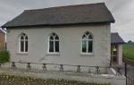
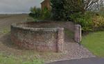
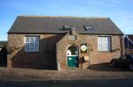
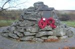

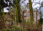

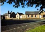

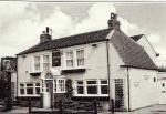


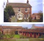
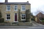
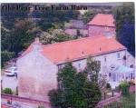
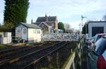
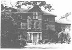
RAWCLIFFE AND CLIFTON WITHOUT
| Site | Address | Date | Description |
| Hospital Chapel | Clifton Hospital Site View on map |
1873 | A chapel built for the use of patients in the North Riding Asylum by architects Gould & Fisher, described in The British Architect journal 1874 as "A handsome and convenient chapel" Damaged during WW2, some fittings and the East window were replaced and re-dedicated 1948-1950. An important landmark across the flat lands of the ings. (HER no. MYO4079) |
| Pavilion Cottages | Clifton Hospital Site |
A pair of cottages combined with a cricket pavilion. They were constructed as part of the Clifton Hospital facilities, providing a pavilion for the Hospital cricket team and residential accommodation for staff. Included on the Local List as a rare and unusual example of a hybrid sports facility and their interest and place in the story of the development of sports facilities and structures. (HER no. MYO4082) |
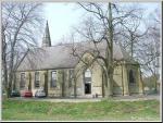
STRENSALL
| Site | Address | Date | Description |
| The Fox Inn | Stockton on Forest View on map |
Last remaining 'pub' in the village on a site which has housed an inn for over 150 years. The original small building is still identifiable. There is an interesting range of out buildings. It provides the village with much needed social amenities. Boarded up and in danger of demolition Nov. 2012 |
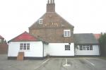
YORK GENERAL
STRENSALL
| Site | Address | Date | Description |
| Strensall signal box | View on map |
c 1846 | A remnant of early railway history and the village's links with the railway network. Still fully operational. (HER no. MYO4125) |
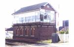
RURAL WEST YORK
| Site | Address | Date | Description |
| Rufforth Manor | Rufforth View on map |
Mid 1800's | Large Victorian Manor House. A fine buildingwhichreplaced Pear Tree Farm as the "Manor". Donated by village benefactors, Misses Middlewood to York Diocese c1895 for use as a vicarage. (HER no. MYO4162) |
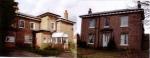
STRENSALL
| Site | Address | Date | Description |
| Telephone kiosk, Strensall | Church Lane View on map |
1935 | The red kiosk is a village landmark and is an example of a design that is becoming increasingly rare. There was another kiosk adjacent to the village playing field, but this was removed some time ago. (HER No.MYO4126). |
| St. Mary's Hall | 1 Church Lane View on map |
1823 | This was Strensall's first Methodist Chapel, becoming a community hall 1895 and renamed St. Mary's Hall. It was converted to domestic use in 1922 but has been unoccupied for several years. The building situated within Strensall's conservation area is of significant historic interest. (HER no. MYO4127) |
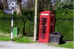
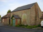
FULFORD AND HESLINGTON
| Site | Address | Date | Description |
| 46 & 47 Main Street | Heslington View on map |
19c | A pair of 19th century cottages situated along Main Street, Heslington. Each cottage has two 12 pane sash windows at the front and the entrances sit either side of the cottages. Contributes to the charming streetscape of the village conservation area. (HER no. MYO4083) |
| The Deramore Arms | Main Street South View on map |
Once called the Yarburgh Arms, the Deramore Arms is a great example of an Edwardian public house. The pub's architectural design consists of clamp brick construction with overhanging eaves & soffits, leaded casement windows with arched brick lintels. The pub served the village community and contributes to the attractive street view of the Main Street in Heslington. (HER no. MYO4084) | |
| Rose Villa | Main Street View on map |
19c | Adding to the historic conservation area, Rose Villa is a great example of a well preserved Victorian villa. The design of the villa includes five 16 pane sash windows at the front, two dormer windows with Yorkshire slide sashes as well as a pannelled front door with an ornate Victorian portico around the door. (HER no. MYO4085) |
| Home Farm | Heslington View on map |
19c | Home Farm is a 19th century former village farmhouse which fronts onto Main Street. The front of the farmhouse consists of five 12 pane sash windows and a simple transom over the front door. The design of the farmhouse is consistent with other cottages and farmhouses along Main Street and contributes to the conservation area. The farmhouse has been converted for office use by the University of York which is located north of the village. (HER no. MYO4086) |
| Woodyard Farmhouse & Woodyard Barn | Heslington View on map |
19c | Woodyard Farmhouse and Woodyard Barn are a pair of small brick cottages built in the 19th century for agricultural purposes. The cottages have original style Yorkshire-light windows and 16 pane sash windows. The cottages add to the existing street view of the village and contributes to the rustic and historic nature of the area. (HER no. MYO4087) |
| Rose Cottage | Main Street View on map |
19c | Rose Cottage is an attractive Georgian cottage along Main Street. The frontage of the cottage consists of two large bay windows on the ground floor, two 16 pane sash windows and one 12 pane sash window in the centre of the first floor. The front door is 6 panelled with a leaded portico and decorative transom. The cottage adds to the street view within the conservation area. (HER no. MYO4088) |
| Sycamore Cottage | Heslington View on map |
19c | Sycamore Cottage fronts onto Hull Road and is a former Victorian estate worker's cottage. The cottage consists of five 12 pane casement windows, a 6 panelled door and two chimneys. The cottage is another addition to the village's conservation area. (HER no. MYO4089) |
| Eden's Cottage | Heslington View on map |
18c | Eden's Cottage was originally two separate cottages before being converted into one cottage. Formerly a pair of Georgian estate worker's cottages, the building was constructed using clamp brick and has some original fenestrations around the front. (HER no. MYO4090) |
| Walnut Farm | Heslington View on map |
Early 19c | Walnut Farm is a Georgian farmhouse situated on Main Street in Heslington. The farmhouse was built from brick with a six panel door with orate transom and seven 16 pane sash windows that adorn the front elevation. The front of the property is covered by vegetation and the overall construction of the farmhouse contributes to Heslington Conservation Area. (HER no. MYO4091) |
| Dalham House | Heslington View on map |
Early 19c | Situated at the entrance of the village, Dalham House is a Georgian brick built farmhouse with 16 pane Georgian styled sash windows and Victorian additions. The cottage contributes to the aesthetic charm of the village. (HER no. MYO4092) |
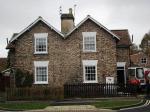
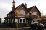
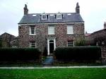
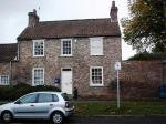

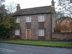
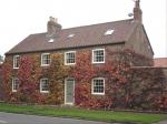
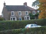
MICKLEGATE
| Site | Address | Date | Description |
| Part of wall, St. Clement's Priory | St. Clement's Priory View on map |
1130 to 1536 | Rubble limestone wall incorporating brick fragments approx. 1.5 metres high and 7.25 metres long. Probably part of the cloister range of the Benedictine Order Clementhorpe Nunnery founded by Archbishop Thurston between 1125 and 1133. The Nunnery was dissolved in 1536 and the buildings passed into secular hands. Contemporary sketches show some buildings surviving in 1705 and 1825 but all were finally demolished by 1873. This fragment of wall excavated in 1976/7 is the only surviving evidence of the Nunnery which perpetuates the Anglo-Saxon name of the locality before the Conquest. The remaining part of the wall has great evidential and historic value, serving as the only remainder of the underresearched priory. See 'The History of Clementhorpe Nunnery' R.B. Dobson & S.Donaghy, 1984, York Archaeological Trust for more information. (HER no. MYO4078) |
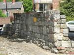
HOLGATE
| Site | Address | Date | Description |
| Railway Stables | Leeman Road View on map |
1900 | The existence of these stables is a reminder of the major role played by horses on the railway and in towns. This extremely rare survival of a large stable range is illustrative of its original function despite later conversion to other uses. They have a visual and functional group value with the old Goods Station, now the National Railway Museum, and the adjacent Coal Manager's office. Of High Historical & Evidential Significance. (HER no. MYO4067) |
GUILDHALL
| Site | Address | Date | Description |
| The Punch Bowl | Public House View on map |
c1838 | Believed to have been a later 19th Century remodelling of two terrace houses built by 1838 appearing on the 1852 OS map. The Punch Bowl is an interesting landmark building which makes a significant contribution to area character and townscape at this nodal location. Its "Dutch" style end gabling and matching scrolled parapet to the main frontage making it architecturally distinctive. It is, moreover, a much valued community asset. |
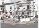
FULFORD AND HESLINGTON
| Site | Address | Date | Description |
| The Saddle Inn | Main Street View on map |
19c/20c | Built for Tadcaster Tower Brewery Co. (probably by Samuel Needham, a local architect), the Saddle Inn is an attractive example of a turn of the century public house. The inn has a large porch hood over the entrance and has a side passage that leads to a yard and stables. Visually, the Saddle is recognised for its positive contribution towards the area character of the historic townscape of Fulford and Fulford Conservation Area. It also is a highly valued community asset. |
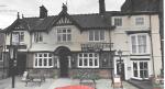
GUILDHALL
| Site | Address | Date | Description |
| Former fire station | Clifford Street View on map |
1855/1938 | Sympathetic re-use of chapel converted to fire station, this brick and stone building having now served the community for over 150 years. The chapel, built to relieve congestion on Castlegate and formerly a Methodist 'New Connection' building demonstrates an aspect of York's religious history. Built on the site of a Franciscan friary, founded in around 1230. It was designed by J.B. & W. Atkinson, Architects, opened in 1855 and converted in 1938. The Peckitt Street aspect is of considerable architectural interest, 19C red brick civic building, which is not intrusive in its setting. The chapel facade remains on this mixed use development. |
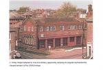
RURAL WEST YORK
| Site | Address | Date | Description |
| Lord Nelson Public House | Main Street, Nether Poppleton View on map |
C17 | The age of this public house, combined with its communal use over centuries for hospitality, justify its inclusion in the Local Heritage List. The pub is said to have been built in the 17th century and originally called The Cross Keys. It was used as a hospital during the Battle of Marston Moor (1644), giving it historical value. It was renamed The Lord Nelson after the Napoleonic Wars to commemorate the naval hero who lost his life at the Battle of Trafalgar (1805). Criterion achieved • Artistic • Historical Association • Communal • Archaeological • Age • Rarity |
| The Old Vicarage | Church Lane View on map |
C17 | Former vicarage with c.17th century origins, situated on one of the few undeveloped medieval burgage plots remaining in the village. The building’s form is of a later vernacular style, with alterations made in the early-mid 19th century. It is of painted brick with both slate and clay pantile roof slopes, with decorative brick banding to the front elevation, four-pane sash windows to all elevations, and three extant chimney stacks. An attached painted brick wall with stone coping forms a walled garden. The extant medieval burgage plot is a rare remnant of the medieval planned village. Criterion achieved • Artistic • Historical Association • Communal • Archaeological • Age • Rarity |
| Cart Shed, Nether Poppleton | Church Lane View on map |
Various | Mid-late 18thC brick cart sheds, with arches added later. It was part of the old Manor Farm, and, as such, is a surviving example of the rural, working nature of Nether Poppleton. It is a rare extant building type. The scarcity of this building type gives the nomination rarity value, while the form and function of the cart sheds are demonstrative of their time and add some age value. Criterion achieved • Historical Association • Age • Rarity |

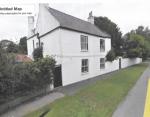
CLIFTON
| Site | Address | Date | Description |
| Burton Stone Community Centre | View on map |
1939/1940 | Originally a gymnasium/hall for Water Lane Girls High School. The first purpose built Local Education Authority secondary school in York, designed by York architects Penty & Thompson.It is in an attractive streamlined moderne style with sleek curved walls and elegant fenestration, an aesthetic style not well represented in York. The choice of materials scale etc. are in keeping with the vernacular of the 1930's local housing scheme. Once York's first public ownership provided Youth Centre it is currently a popular & well used community centre. It is also of national significance being assciated with the government National Fitness Campaign started in 1937 |
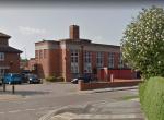
HOLGATE
| Site | Address | Date | Description |
| The Jubilee | Balfour Street View on map |
1897 | Opened in 1897 to the designs of nationally-renowned, York-based architect, Walter Brierley, for the Tadcaster Tower Brewery, The Jubilee public house offers strong design and architectural qualities. It was purpose built as a public house for the emerging Leeman Road community with strong railway-industry connections, and also offered accommodation. Offering a designated and attractive 'function room' on the first floor, The Jubilee holds high communal significance in having been at the heart of the community since for over a century. (HER no. MYO4265) |
RAWCLIFFE AND CLIFTON WITHOUT
| Site | Address | Date | Description |
| Blue Beck House | View on map |
1891-97 | Along with Verandah Cottages (also on York's Local Heritage List), Blue Beck House is one of few remaining buildings on the site of the now-demolished Clifton Hospital (of 1851, designed by George Gilbert Scott with William Bonython Moffatt, architects of national repute who worked prolifically in the asylum and workhouse fields). The wider, former hospital site is of importance due to it having been chosen for the new asylum as an airy, accessible site between Clifton Ings and Shipton Road, providing an extensive parkland setting. While the site has been lost due to extensive demolitions and unsympathetic redevelopment, the landscape of the site remains legible and distinctive in character; the extant buildings, including Blue Beck House, punctuate the landscape orientating and referencing the history of the site. Thought to have been the hospital's laundry, Blue Beck House was completed in 1891-7. The upper floors housed female inmates who worked in the laundry on the ground floor. Blue Beck House has intrinsic architectural quality which merits conservation. Designed by the firm of George Fowler Jones of York in red brick under slate roofs, the building adopts the English domestic revival architectural style, exemplified in its extensive stone dressings; mullion and transom windows with cast iron lights; timbered gables and attic storey to the hipped tower; and leaded ventilation cupola. The design and construction of the building is of high quality, great character, and possesses significant aesthetic design values; historical illustrative and associated values relating to its historic function and association with the hospital and Fowler Jones; and communal heritage values relating to the historic and current uses for health services. (HER no. MYO5270) |
| Verandah Cottages | View on map |
c.1860s-1870s | Along with Blue Beck House (also on York's Local Heritage List), Verandah Cottages are among the few remaining buildings on the site of the now-demolished Clifton Hospital (of 1851, designed by George Gilbert Scott with William Bonython Moffatt, architects of national repute who worked prolifically in the asylum and workhouse fields). The wider, former hospital site is of importance due to it having been chosen for the new asylum as an airy, accessible site between Clifton Ings and Shipton Road, providing an extensive parkland setting. While the site has been lost due to extensive demolitions and unsympathetic redevelopment, the landscape of the site remains legible and distinctive in character; the extant buildings, including Verandah Cottages, punctuate the landscape orientating and referencing the history of the site. Verandah Cottages are likely to date from the 1860s-70s and provided family housing to members of staff of the Asylum. Designed in a cottage style with multiple gables, overhanging eaves, large modelled chimney stacks and detailing including finials and red brick dressings, they have an ornamental quality and of great charm and possess significant aesthetic design value. As a consequence of the heritage significance of Bluebeck House and Verandah Cottages identified, it is considered that both buildings qualify as non-designated heritage assets defined in the Planning Practice Guidance as “having a degree of significance meriting consideration in planning decisions”. (HER no. MYO5271) |
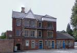
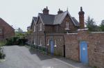
FISHERGATE
| Site | Address | Date | Description |
| The Limes | 135 Fulford Road View on map |
1903 | The Limes is an Arts & Crafts styled Edwardian house along Fulford Road which is currently operating as a hotel. Built by a prominent local architectural firm, Penty & Penty, the house holds strong aesthetic and architectural significance. The front elevation is symmetrical with attractive brick, gable, and window detailing. Penty & Penty have several buildings within the city, all offering a similar Arts & Crafts aesthetic, making this group of buildings distinctive. The Limes is a great example representing the Arts & Crafts movement during the 20th century and contributes to the street view within the conservation area. (HER no. MYO5291) |
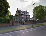
OSBALDWICK AND DERWENT
| Site | Address | Date | Description |
| Osbaldwick Village Hall | Osbaldwick Village View on map |
1871 | Osbaldwick's former (Wesleyan) Methodist chapel of the 1871, quite well-preserved, with handsome proportions and decorative brickwork including gable glazed brick dentil details. Subsequently used as a nursery and Osbaldwick's Village Hall, adding to its communal significance. (HER no. MYO5292) |
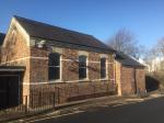
HAXBY AND WIGGINTON
| Site | Address | Date | Description |
| Former Tannery / Farm, Wigginton | 11-13 The Village, Wigginton View on map |
From early 19thC | The site of a historic farmstead/ tannery, representing a good survival of associated 19th-century buildings which are characterful remnants of a historic village farm (including a charming double-fronted cottage/barn in gardens). Largely intact evidential significance of an undeveloped farmstead plot. Subsequent histories as tannery, reversion to farming use, and finally the remodelling of the site in c.1970 with house by York-architect Ronald Sims give it additional layers of architectural, historical, community and townscape significance. (See The Buildings of England. Yorkshire: The North Riding (2023, p.739). While the tannery was demolished in 2023, the cottage/barn remains, providing now even-rarer evidential significance of the historic farmstead (HER no. MYO5293) |
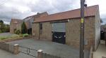
RAWCLIFFE AND CLIFTON WITHOUT
| Site | Address | Date | Description |
| 1-6 South Cottages | Shipton Road View on map |
1911 | Locally listed due to the row of cottages’ architectural and historical significance as a work of the Brierley firm of the early C20 period, with characteristic architectural treatment of restrained brickwork with rusticated brick quoin embellishments for end gables, pitched roofs with oversailing eaves, and, originally, use of 'three over six' timber windows; particularly nice as a scheme of "married attendants" workers’ cottages and contrasting with Brierley’s more familiar large house and civic buildings output; and as a surviving component of the County Asylum estate. Having suffered from a few unsympathetic alterations (small extensions, insertion of French doors, PVC windows), the row's architectural character remains strong: internally, all the principal rooms face south, with service rooms on the north side; they are unusual in their T-shape and having two yards, north and south. The site of the cottages is hidden from the main Shipton Road and the arrangement of gardens on their south side which acts as the architectural "front", across which residents have rite of passage across each other’s property, giving a particular communal spirit to these buildings. The north side features little yards with fuel stores and acts, effectively, as the main entrances, with a common lane, and then garths facing across the lane. The landscape setting of the cottages is charming and likely relates to the cottages’ relationship with the former asylum; to the south, open land leading to an orchard (assumed to have been part of the asylum grounds). The setting has been diminished by encroaching, unsympathetic development of recent years, in particular the estate which was built on sale of the hospital site. The cottages have been cited in the revised version of North Yorkshire Pevsner, edited by Jane Grenville, as valuable assets. Their construction is recorded in the Clifton Hospital Archives at the Borthwick Institute and there is a plan of the elevation of the row with details filled in for No 1. (HER no. MYO5294) |
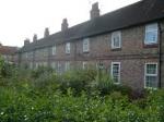
GUILDHALL
| Site | Address | Date | Description |
| York Hebrew Congregation Synagogue (former) | 1 Aldwark View on map |
1770 | No.1 Aldwark dates from c,1770 and holds historic, architectural and communal heritage significance in having long-standing use as a Synagogue at first-floor level and an intertwined history with families of joiners operating on the ground floor below. It is one of the modern Jewish community’s most important locations in York. Between 1892 and 1975 it was York Hebrew Congregation’s Synagogue and continues to be a Registered Place of Workshop. The importance of the building is to the history of York, and the long relationship between Jewish people, businesses and York civic life. |
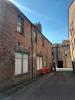
RURAL WEST YORK
| Site | Address | Date | Description |
| Railway Bridge (Skelton Bridge) | View on map |
1839 | The bridge is part of The Great North of England Railway Line that initially connected Darlington and York when open in 1841. The line was amalgamated with other railway companies in 1854 to form North Easten Railway, providing York with railway connections further afield, including Newcastle, Edinburgh, and London. It is one of only two river-crossing railway bridges between Darlington and York: one over the River Tees and this one over the River Ouse. It is one of only three railway river-crossing bridges in the York boundary. Of these, this is the oldest and the only multi-span, stone arch bridge, giving it strong significance for its age and rarity. It is built of sandstone from quarries in Knaresborough and has three elliptical arches spanning 66 ft (20m) each, making the bridge's length nearly 300ft (91m). It was designed by J[ohn] & B[enjamin] Green of Newcastle; most likely by John Green. J & B Green are famous for their churches and bridges, but also Newcastle Theatre Royal and the city's Grey's Monument. The engineer was Thomas Storey (engineer-in-chief of the Great North of England Railway Line). These credentials give it high historical value. Criterion achieved • Artistic • Historical Association • Landmarks • Age • Rarity |
| Barn | Church Lane View on map |
18th/19thC | A traditional brick agricultural building, likely used to shelter animals as evidenced by the air-vent detailing to the street elevation. Variations in the brickwork demonstrate that the building has been historically adapted and changed over time. The attractive rural aesthetic, including brick ventilation, herringbone detailing, and a variety of agricultural openings, demonstrates some artistic and age value. The building is representative of the working, agricultural history of Nether Poppleton, which has become less evident over time, giving the building some rarity value. Criterion achieved • Artistic • Historical Association • Age • Rarity |
| The Red Lion | View on map |
Early to mid-18th C | The Red Lion public house is made up of an attractive central, early-Georgian, two-storey block; a lower side wing in place by 1852; and modern extensions in brick which were completed in the 1970s and 1980s - resulting a moderate aesthetic value. The pub is notable for its historical association with the eighteenth-century evangelical preacher, John Wesley, and the Hodgson family. The latter ran the inn during the reigns of George II and George III. Previous names for the pub include the “Four Mile Post” and “Poppleton House". It currently is also in use as a motel. The building now backs onto the A59 road, but originally this main road – the course of a Roman Road, now the site of its car park – ran the other side of the building. As a stop for travellers, it means that the building has been used historically as both a place frequented by locals, with high communal value – in fact, the lane leading to the Red Lion is named “Hodgson Lane” after the prolific 18th century innkeepers – and as a stop for those passing through. It is likely that John Wesley visited the Red Lion on 18 February 1743, and the Red Lion therefore forms part of John Wesley’s visits to Poppleton. Criterion achieved • Artistic • Historical Association • Communal • Landmark • Age |
| Methodist Chapel | View on map |
1889 | The Wesleyan chapel of 1889 was built to replace an initial 1817 chapel, before which the congregation had spent many years meeting in a barn. The current chapel is of buff brick and stone dressings and features a 1980s extension to the front elevation. John Wesley is known to have visited the area twice, once on 18 February 1743 and again on 13 July 1757, when he preached at The Green at Upper Poppleton. The building has communal value due to the strong, historic Wesleyan community in Poppleton. There is some historical value due to the association with Wesley's Poppleton visits, and some artistic value, although this is somewhat compromised by the 1980s front extension. Criterion achieved • Artistic • Historical Association • Communal |
| Railway Station Signal Box | Poppleton Station View on map |
c.1870s | A now rare example of a North Eastern signal box and semaphore signal, complete with hand operated crossing gates which adds to the rural feel of the village. It is under threat as it is now rail policy to abolish all manned level crossings. Its aesthetic value is weakened due to installation of uPVC windows and the crossing gates are modern. Criterion achieved • Artistic • Historical Association • Age |
| Ivy House | View on map |
Early 18thC | Ivy House (sometimes known as Ivy Cottage) is an c. early-18th century Georgian vernacular building of grand proportions. It is of brick construction with a clay pantile roof, two chimney stacks, and multi-pane fenestration, which, although not original fabric, sustains the character of the building. Along with its gardens, it is the only remaining evidence of a complex of eighteenth-century buildings which once comprised cottage, outbuildings, gardens, and possibly an orchard, likely part of a farm. In the 1960s, the courtyard and outbuildings were demolished, and the building is now surrounded mostly by 20th century development. As a remnant of unenclosed eighteenth-century Upper Poppleton, Ivy House has archaeological (evidential) value, to which the evidence of change over time in the brick detailing and scarring add further interest. The early age of the building and the rarity of remaining historic buildings in the area give the nomination some rarity value, and the attractive vernacular appearance has some artistic and age value. Criterion achieved • Artistic • Archaeological • Age • Rarity |
| Poppleton Community Railway Nursery | View on map |
1941 | The first known railway nursery in York was constructed c.1881, and moved to this site in 1941, where part of Poppleton Station's Goods yard was transformed into an area to produce food for railway workers canteens and railway owned hotels. Post-war, the nursery was used to produce flora to beautify stations along the East Coast Main Line. The nursery has been renovated and extended at multiple points, now with features such as the storage shed which is the former waiting room from Knottingley Station, and a two-foot gauge railway which transports plants around the site. Poppleton Community Railway Nursery was established as a charity in 2009 and now partners with the NHS to deliver horticultural training to adults with mental health issues. It is the only surviving example of a railway nursery in the UK, giving the site significant heritage value based on its rarity, and arguably of interest for national listing. It speaks to York's proud railway heritage and has strong historical value and some age value (of its time), and has contemporary value to the community as a NHS partner. Criterion achieved • Historical Association • Communal • Age • Rarity |
| The Lord Collingwood | View on map |
c.1823 | A traditional vernacular building of painted brick and clay pantile roof, with a variety of multi-pane timber windows, including sliding sash, casement, and an oriel window. The construction date of this building is uncertain but was first mentioned in an 1823 Trade Directory. The pub was previously known as the Lord Hawke, probably after Martin Hawke (1860-1938), an English amateur cricketer who played for Yorkshire and England. Lord Collingwood refers to vice-admiral Cuthbert Collingwood (1750-1810) who was second in command to Lord Nelson at the Battle of Trafalgar (1805) and took command of the fleet during the battle following the death of Nelson. There is strong communal value through the ongoing use as a community gathering space, and through links with the founding of the Ebor Morris dancing group. The traditional brick construction, varied historic fenestration and characteristic rural form of the building afford some level of artistic and age value. Criterion achieved • Artistic • Historical Association • Communal • Age • Rarity |
| Village Water Pumps | Upper Poppleton View on map |
Late 19th C / early 20th C | Upper Poppleton's four late 19th C / early 20th C water pumps. Locations: i.) The Green, 2.) Main Street (corner of Limegarth). 3.) and 4.) two on Station Road. The Green and southern Station Road pumps includes stone troughs. The pumps supplied Poppleton residents with clean drinking water for themselves and livestock. Once a common feature across the country, such pumps are increasingly rare, and these pumps therefore have rarity value. The important, historic public function of the pumps demonstrate communal value, and the design and function place it firmly within its time, giving some age value. Criterion achieved • Artistic • Historical Association • Communal • Age • Rarity |

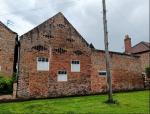
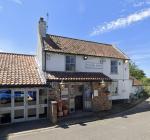

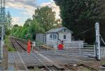
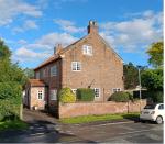
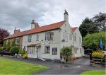
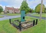
WHELDRAKE
| Site | Address | Date | Description |
| The White Swan Inn | View on map |
1823 | The White Swan Inn is an early 19th-century public house, first recorded as The Swan Inn in 1823. Renamed The White Swan after its façade was whitewashed in the 1870s, it has remained a familiar village landmark for over two centuries. Historic photographs showing chimney alignment and brick markings suggest the original form was a modest two-bay structure flanking a central entrance, later extended on both sides with the chimneys removed. Built of brick, later rendered white beneath a slate roof, the inn typifies the rural public house tradition and contributes strongly to Deighton’s communal identity and historic continuity. |
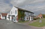
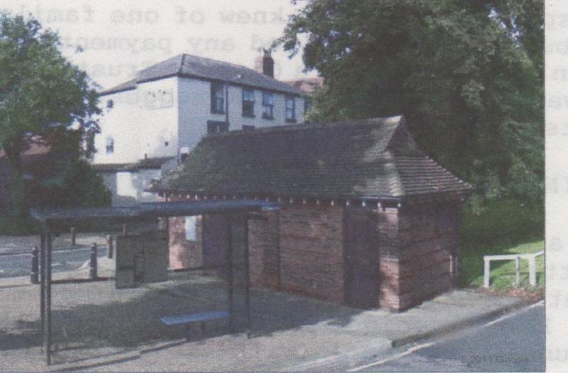
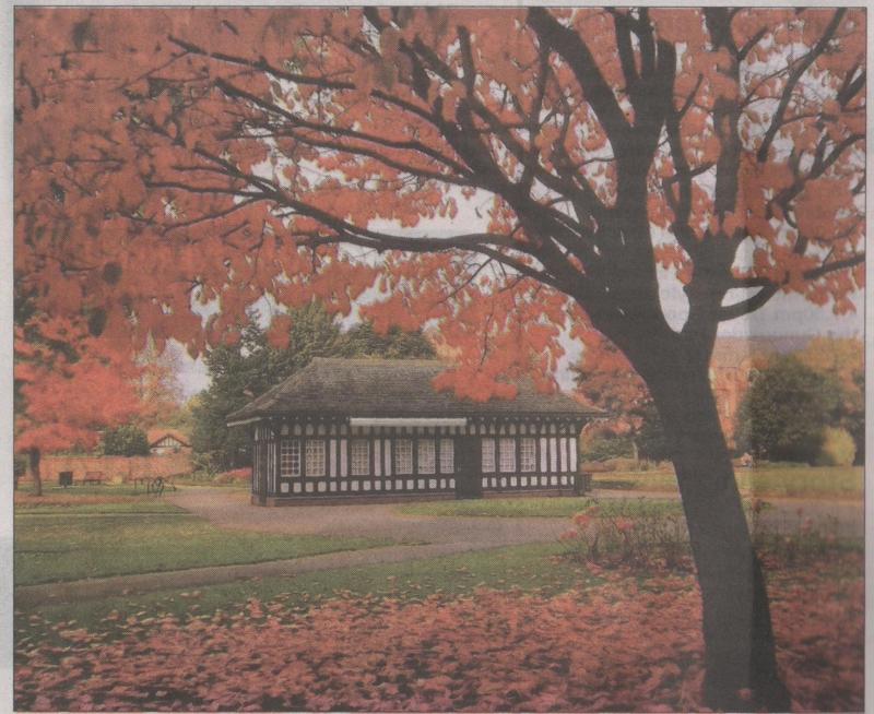
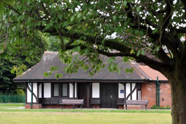
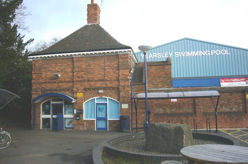
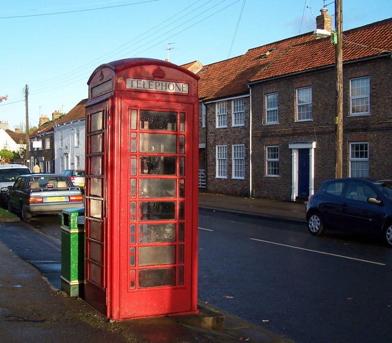
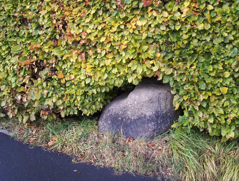
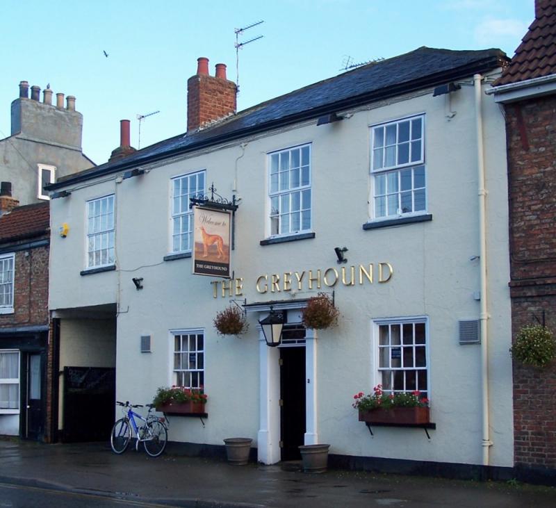
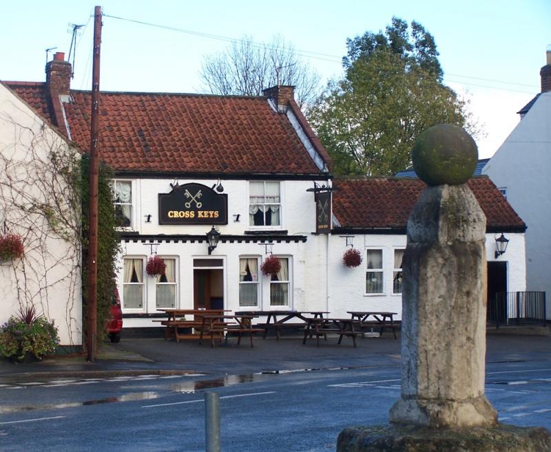
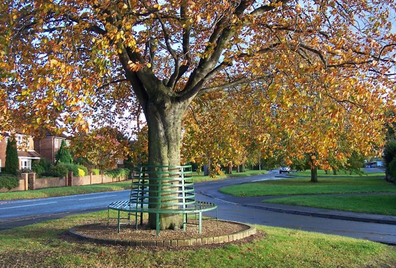
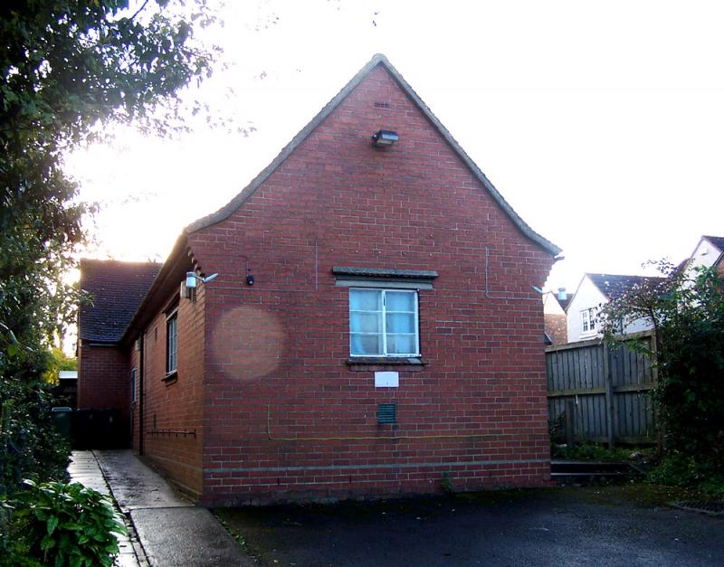
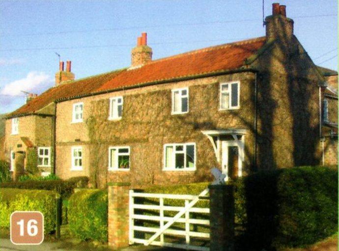
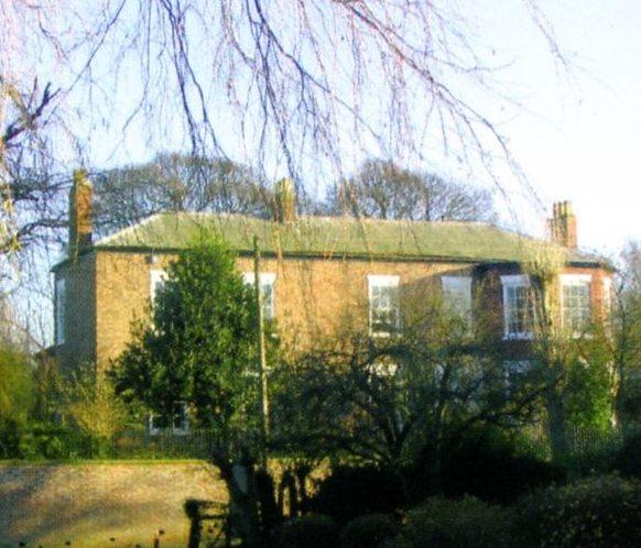
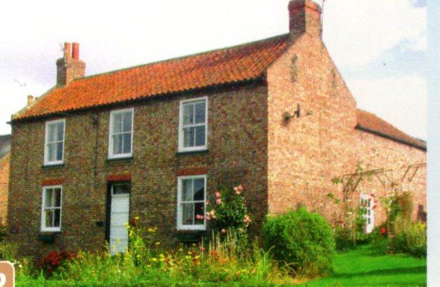
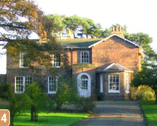
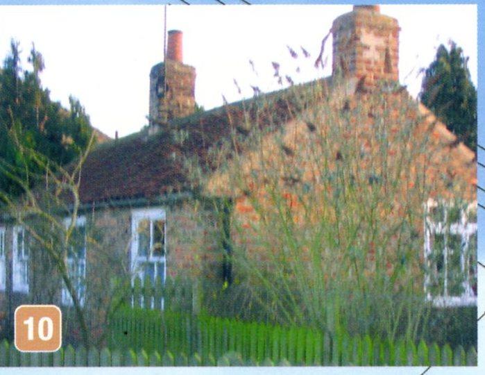
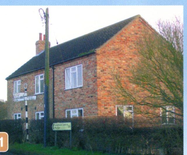
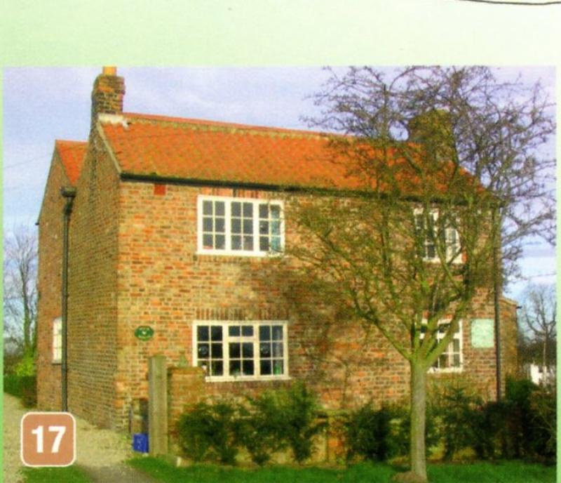
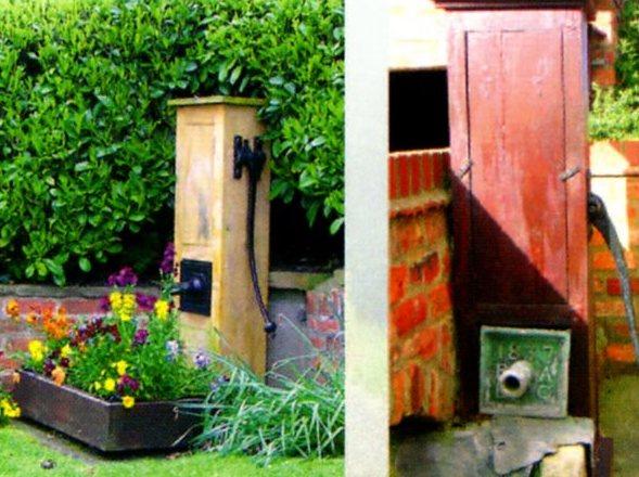
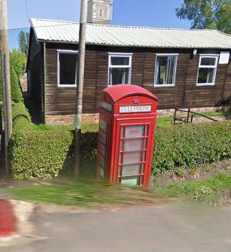
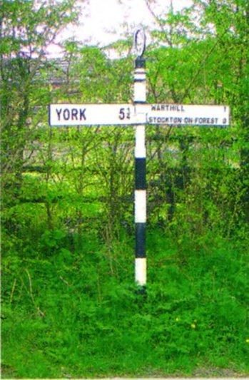
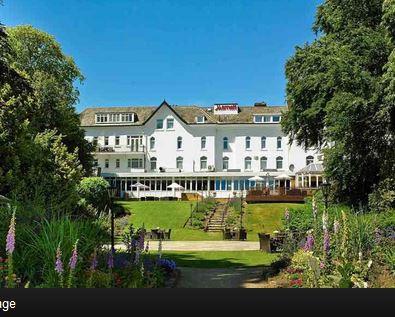
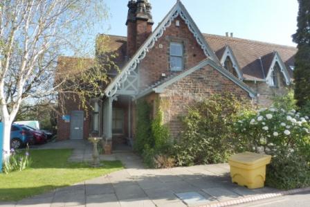
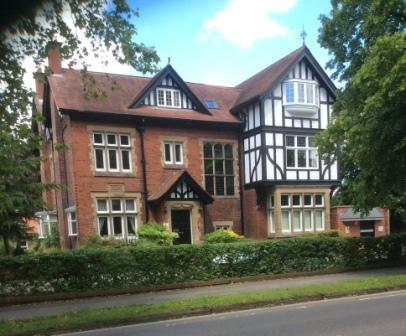
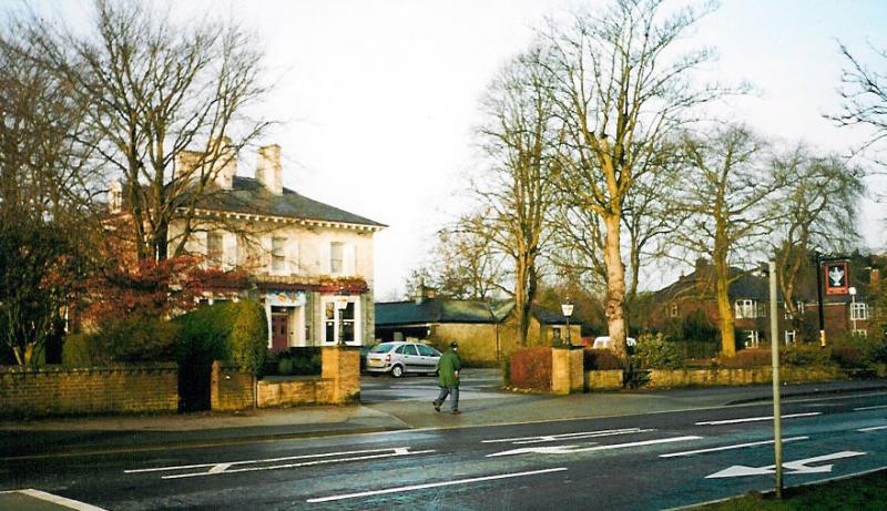
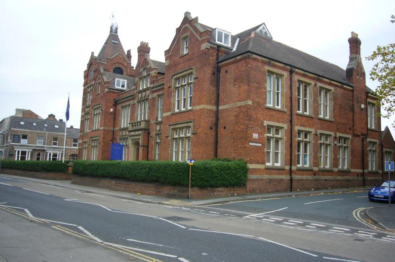
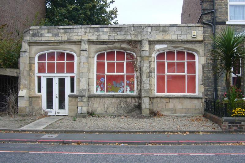
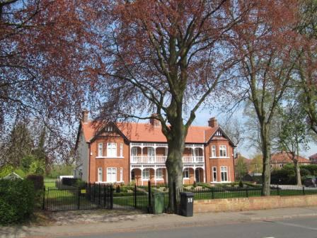
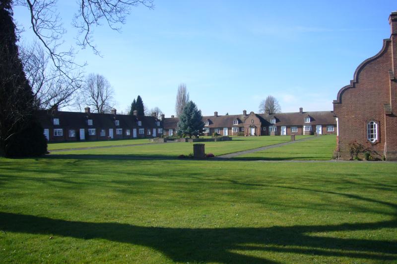
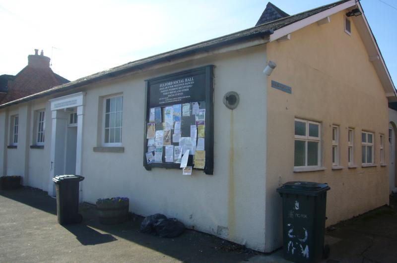
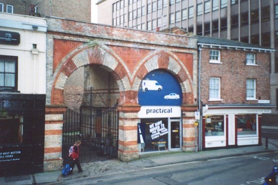
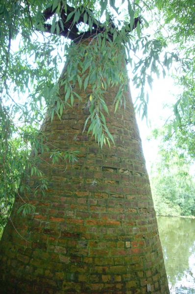
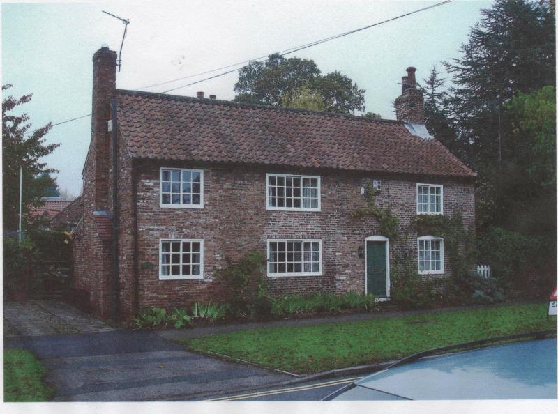
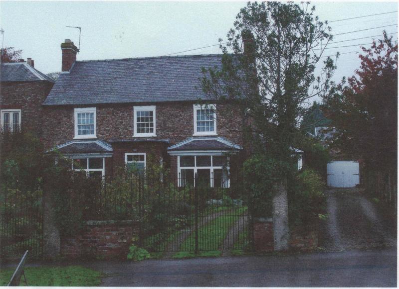
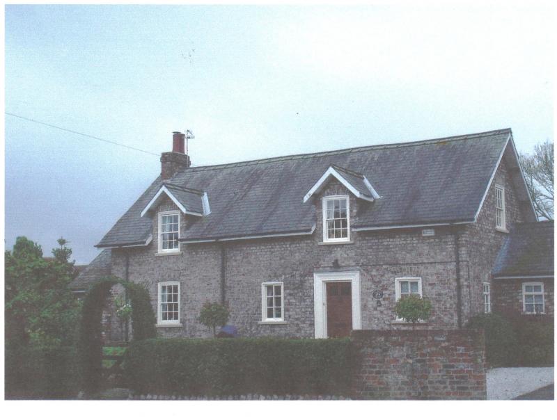
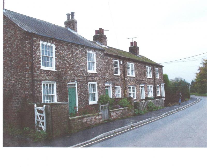
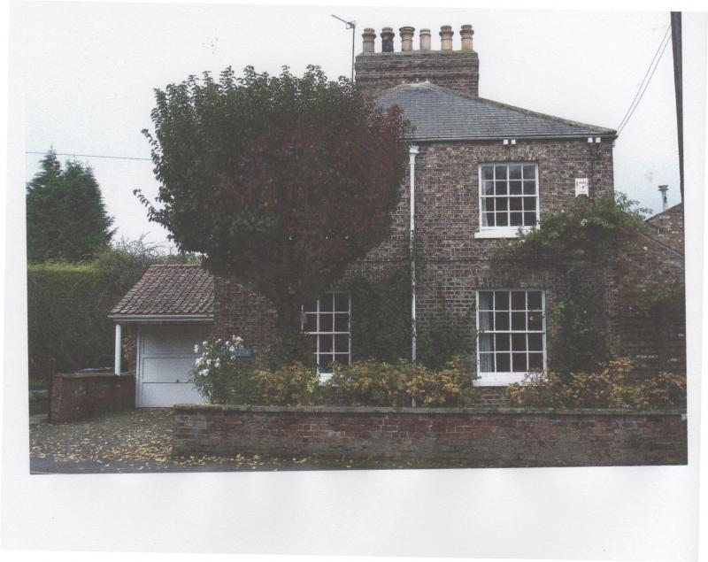
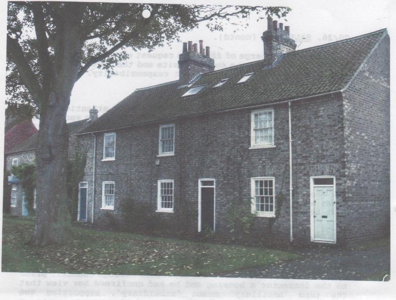
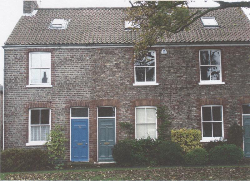
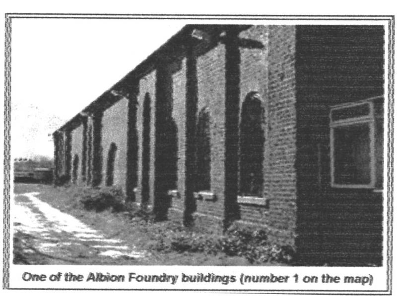
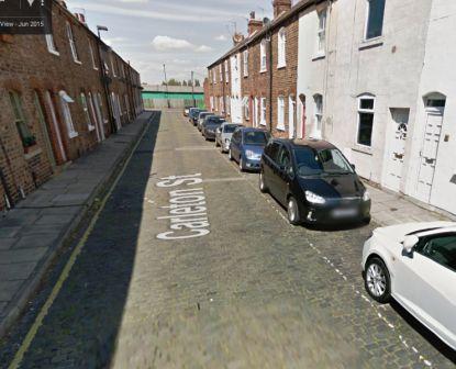
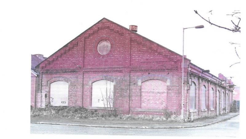
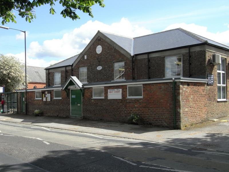
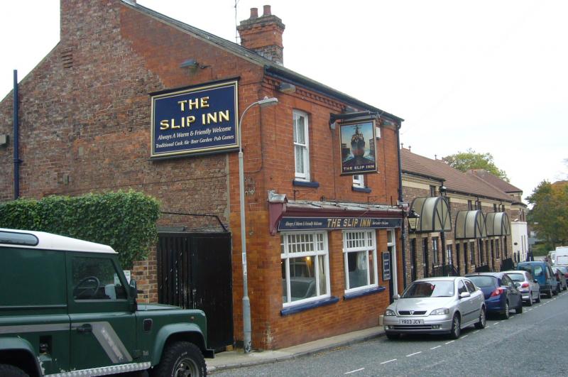
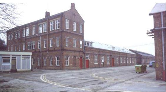
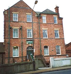
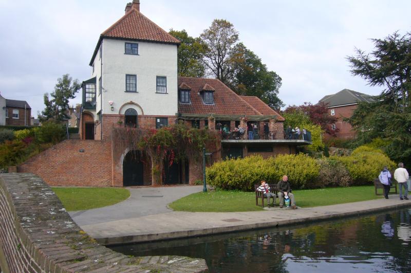
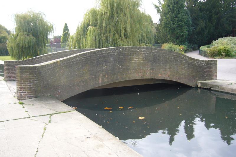
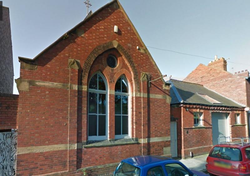
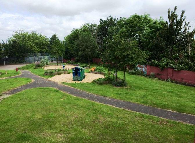
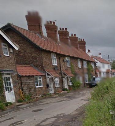
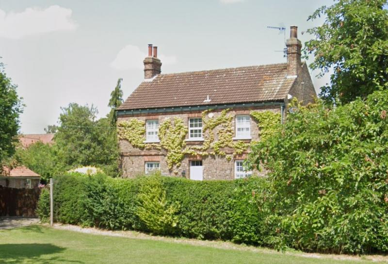
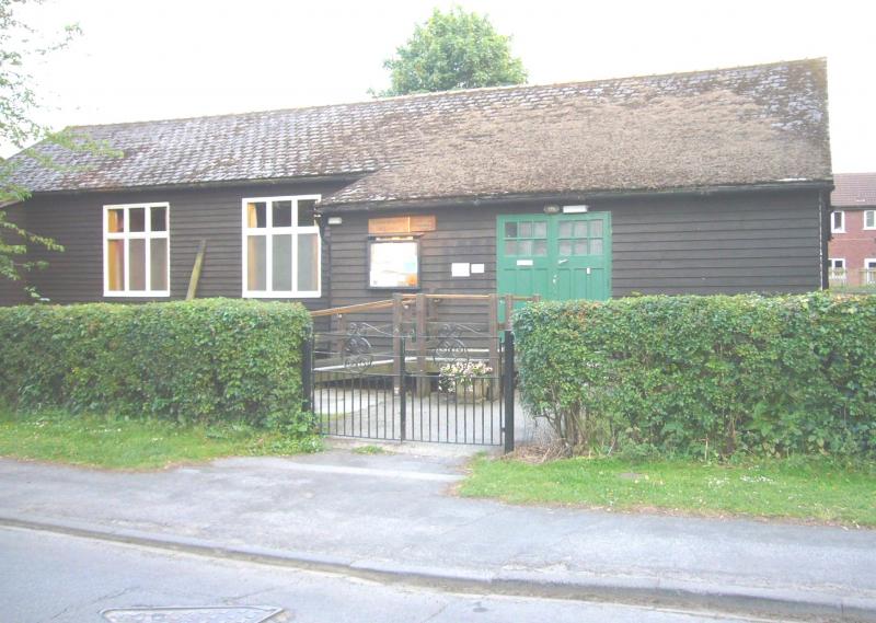
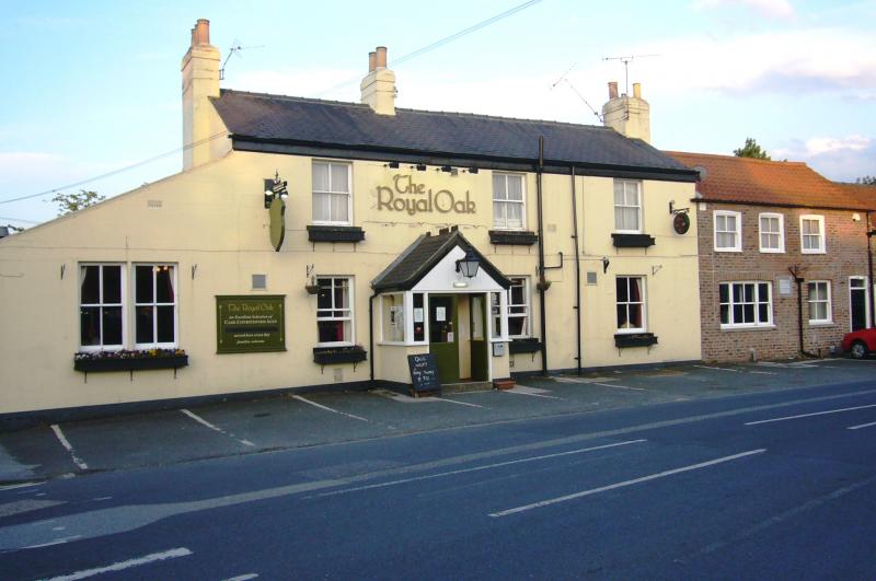
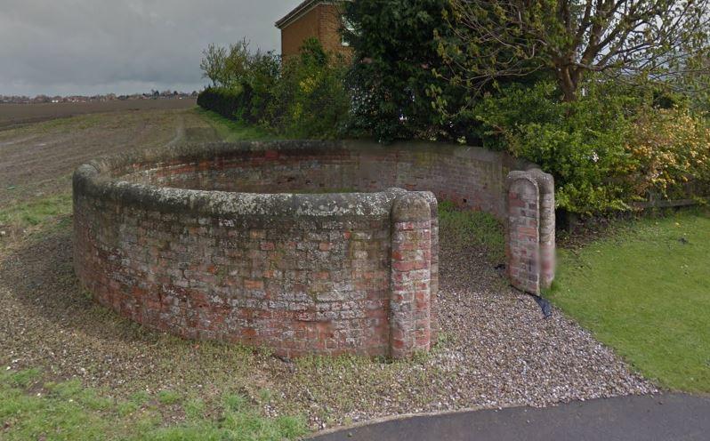
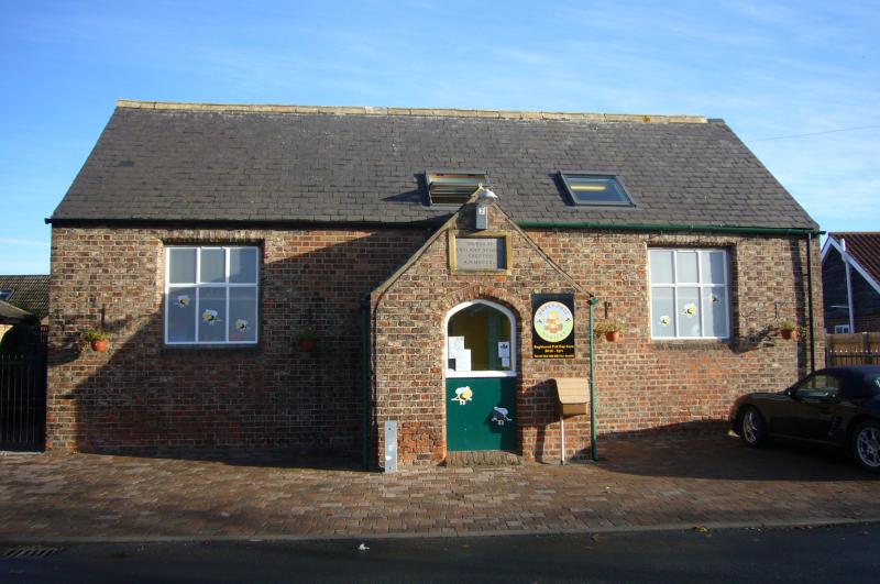
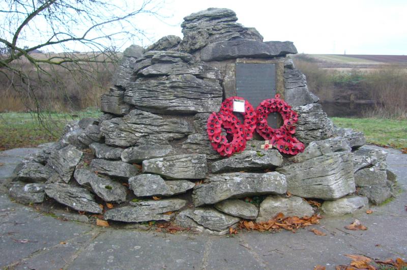
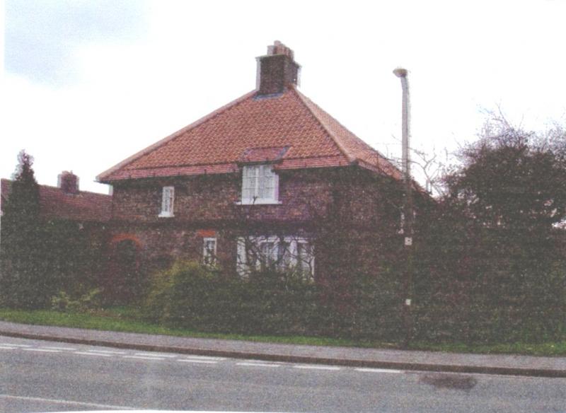
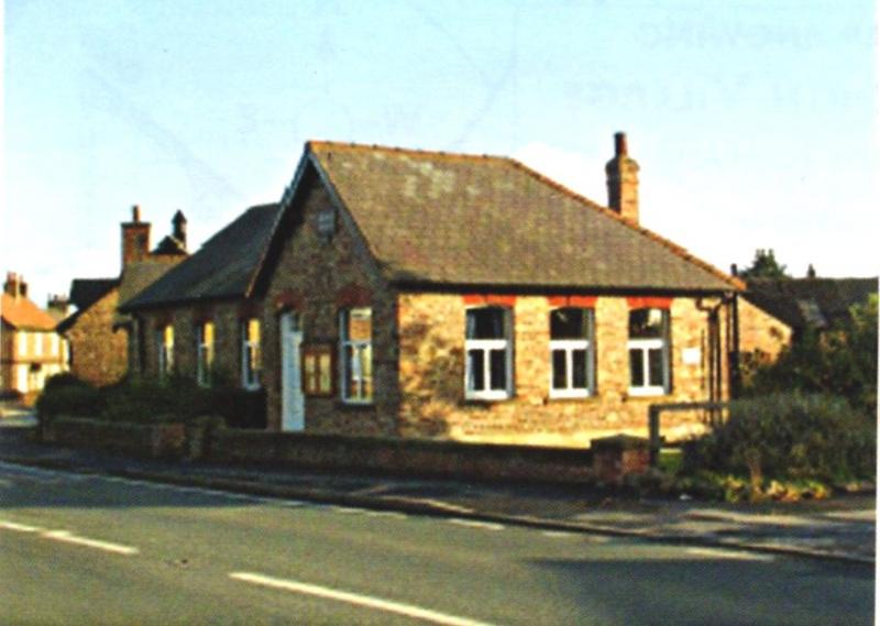
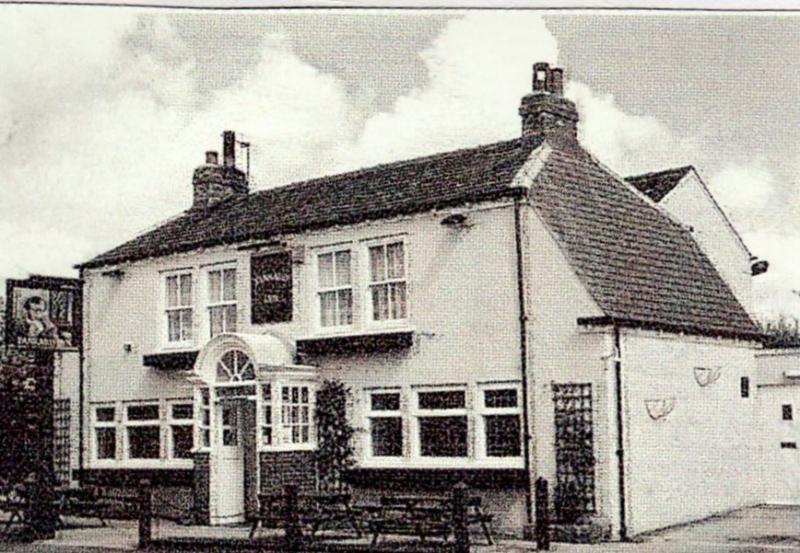
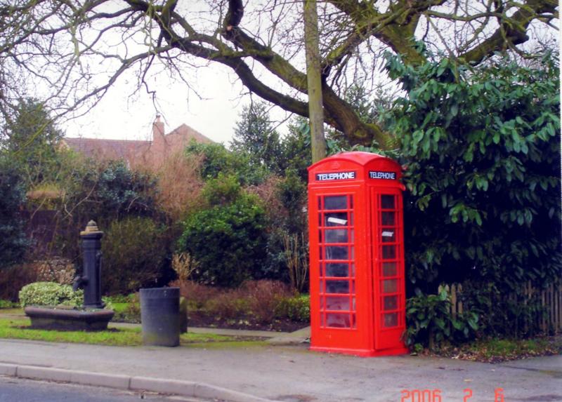
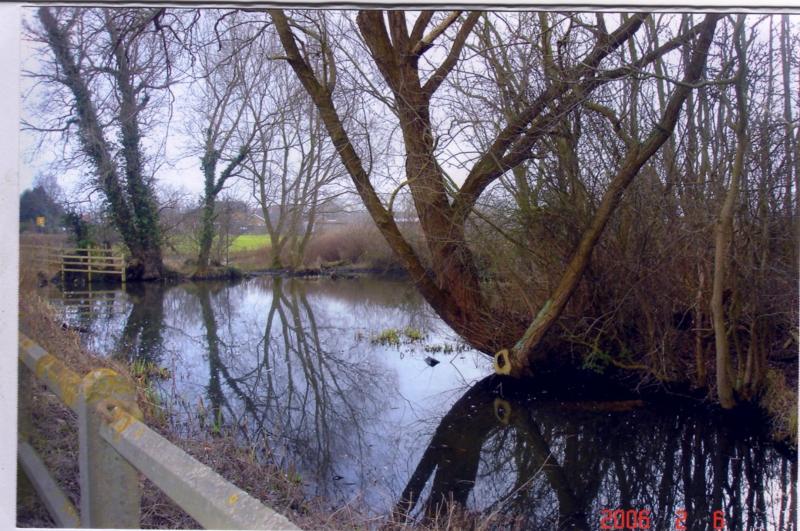
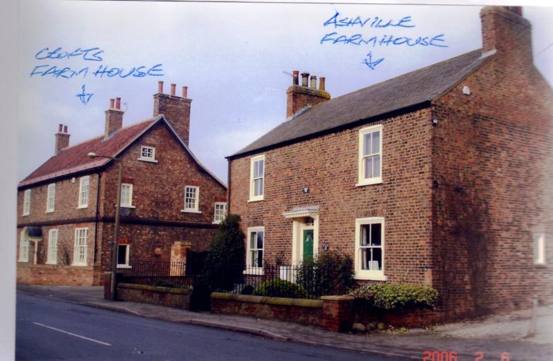
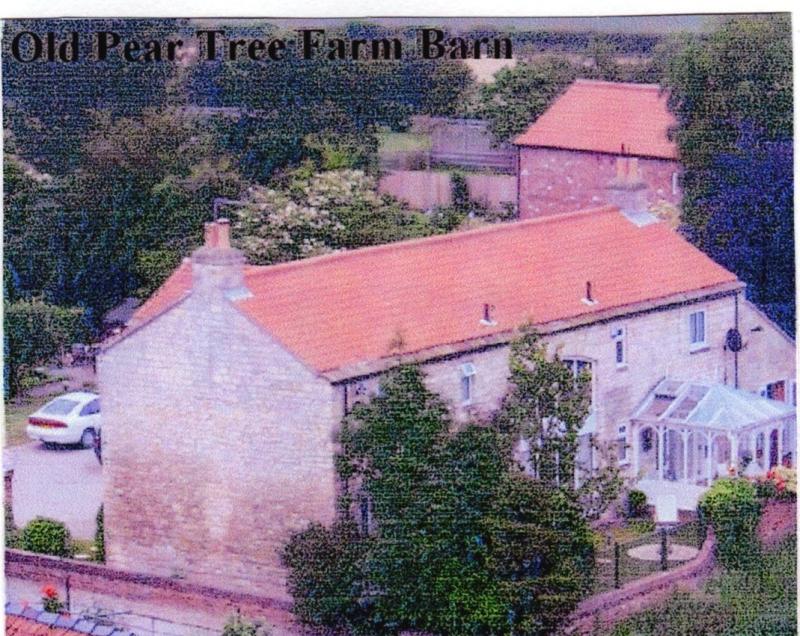
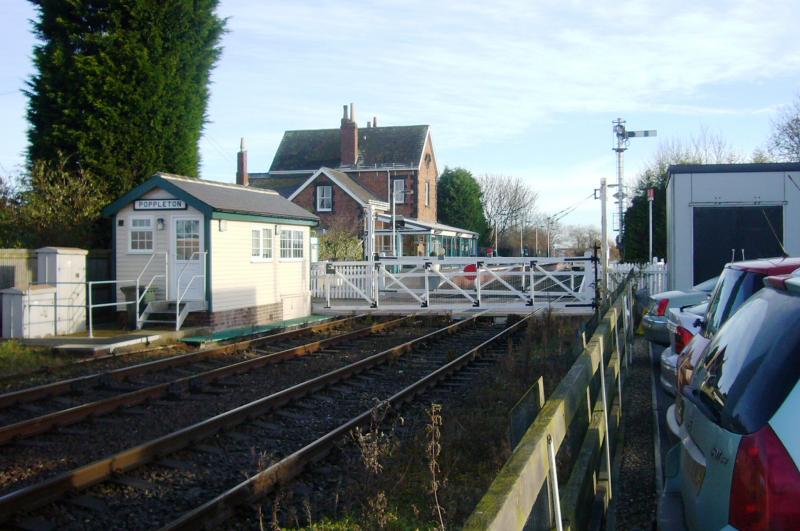
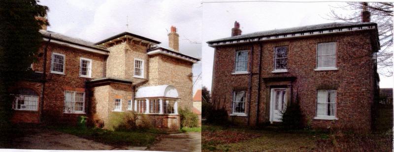
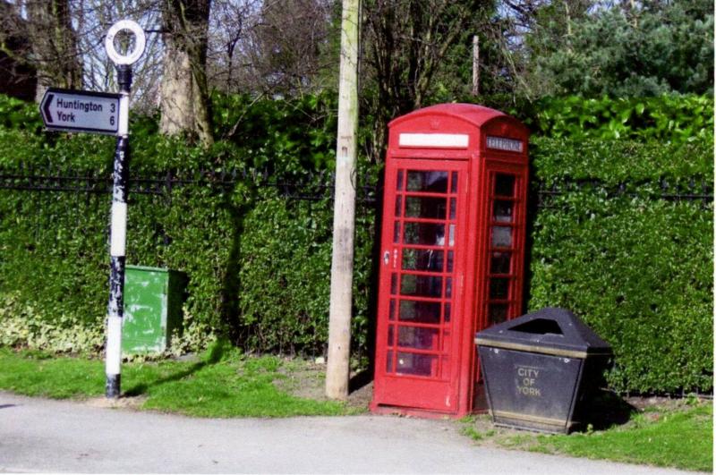
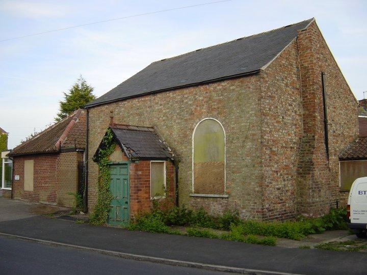
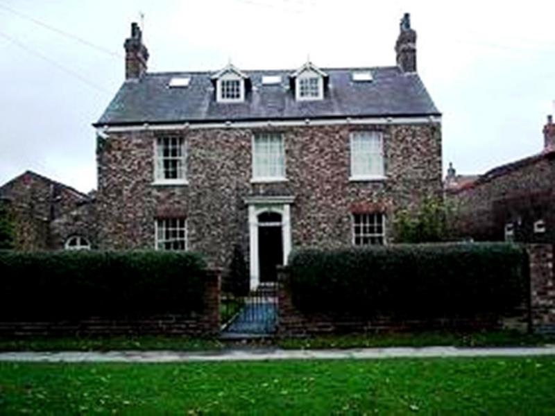
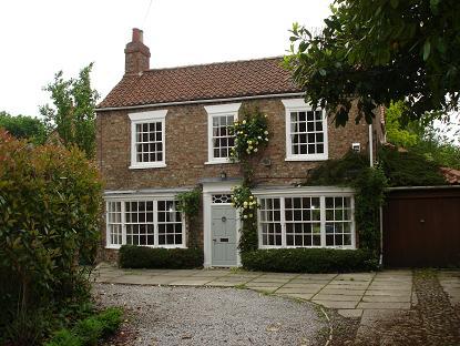
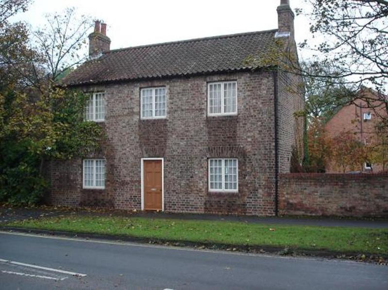
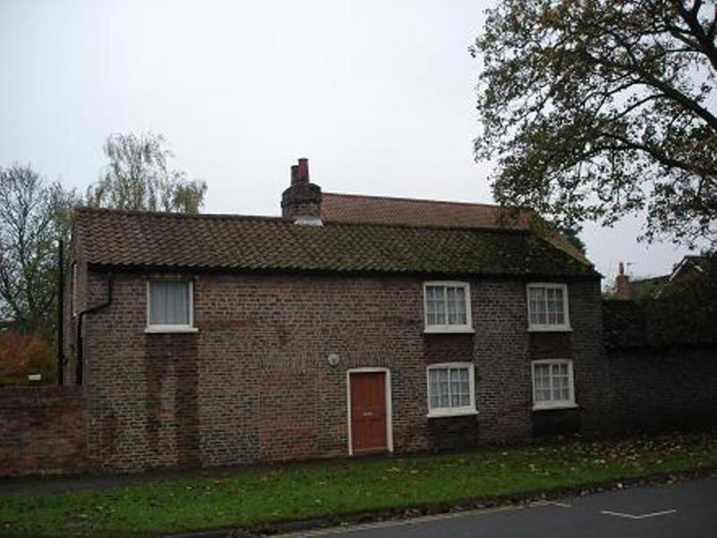
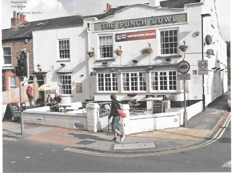
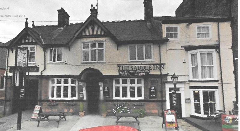
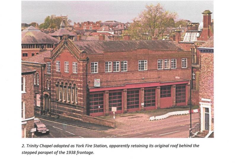
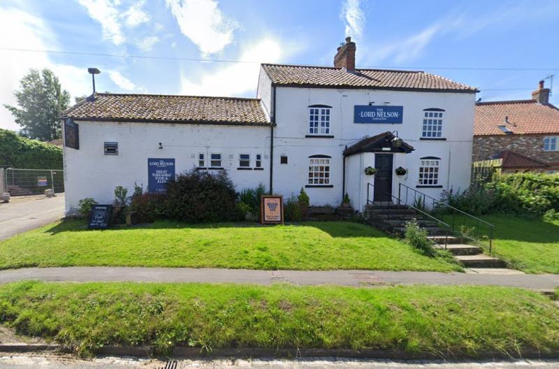
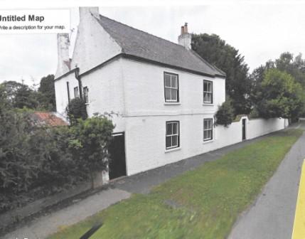
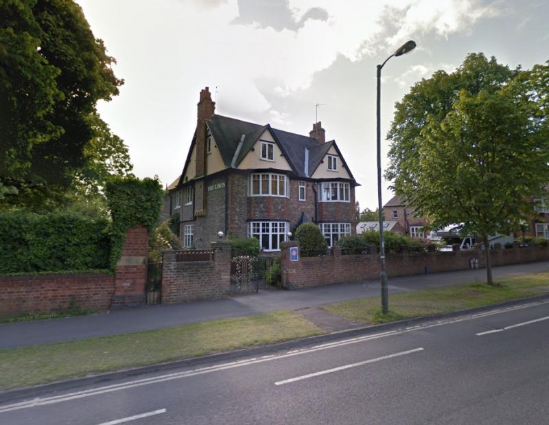
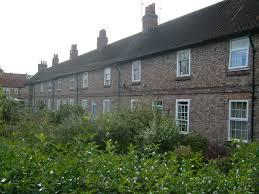
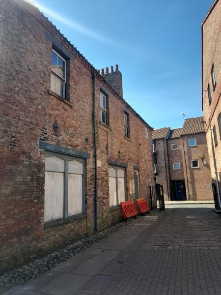
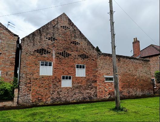
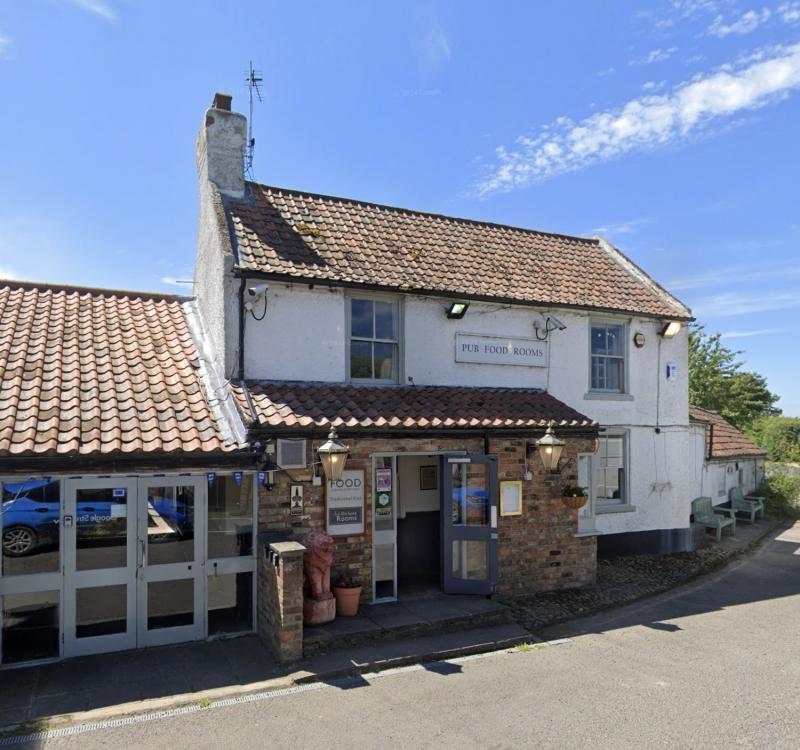
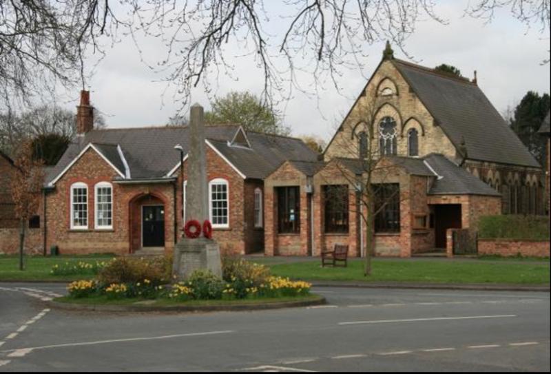
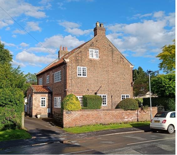
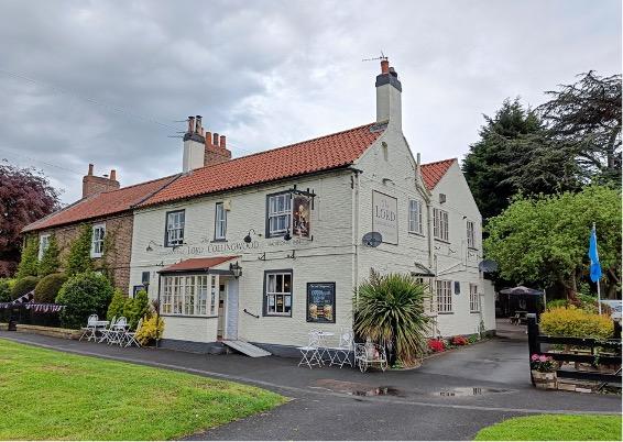
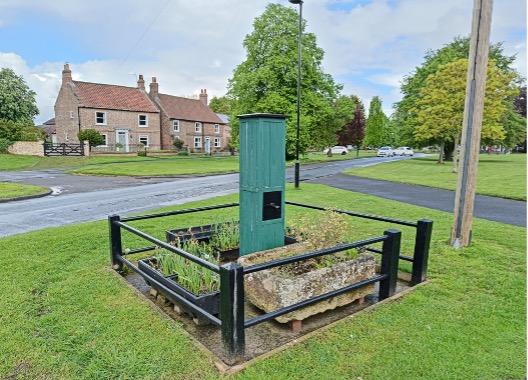